|
search place name
|
||
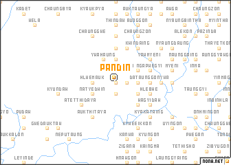
Pandin (Sagaing, Myanmar)Pandin is a town in the Sagaing region of Myanmar. An overview map of the region around Pandin is displayed below.
regional and 3d topo map of Pandin, Myanmar ::
Pandin airports ::
The nearest airport is IMF - Imphal, located 209.3 km north west of Pandin.
Other airports nearby include MYT - Myitkyina (248.6 km north east), Nearby towns ::
Thapan-gon (0.0km north) //
Min-gon (1.7km east) //
Kyaukka (1.7km east) //
Taung-yagyidaw (1.9km south) //
Ywama (2.5km north east) //
Thegaw (2.5km north west) //
Nyaungbintha (3.4km east) //
Kya-in-ashe (3.7km north) //
Hlwe-mauk (3.4km west) //
Kawlin (3.9km north east) //
Thayetkon (3.9km south east) //
Sizon (3.9km south east) //
Ywa-haung (4.1km north west) //
Natye-dwin (3.9km south west) //
Nyaungwun (5.0km south east) //
Wayongon (5.0km south east) //
Da-taunggon-ywa (5.1km east) //
Kyogon (5.6km north) //
Intabin-myaukkon (5.6km north) //
Nga-pwegyi (5.4km east) //
Kyogon (5.4km east) //
Hlebwe (5.4km east) //
Pegon (5.8km north) //
Kwindaing (6.5km north east) //
Yaw-mye-ni (6.3km north east) //
Maunggaw (6.5km south west) //
Auk Thitaya (6.5km south west) //
Yataung (6.5km south west) //
Wagyidaw (6.3km south east) //
[all distances 'as the bird flies' and approximate] 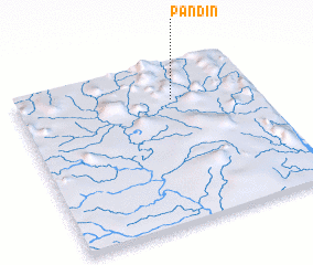 Places with similar names to Pandin, Myanmar ::
Disclaimer :: Information on this page comes without warranty of any kind |
||
|
Where is Pandin? Elevation and coordinates ::
Latitude (lat): 23°46'0"N Longitude (lon): 95°39'0"E
Elevation (approx.): 180m (map arrows pan, magnifying glasses zoom) |
||
|
Visiting Pandin? Hotel/Accommodation ::
Book a hotel in Pandin Travel Guide ::
Buy a travel guide for Myanmar rental cars ::
car rental offers GPS waypoint ::
download a GPX waypoint (PoI) of Pandin for your GPS receiver
|
||