|
search place name
|
||
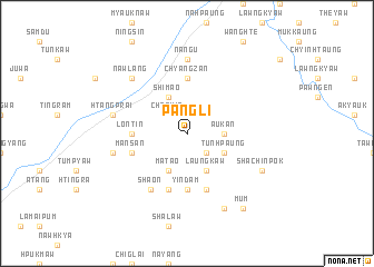
Pangli (Kachin State, Myanmar)Pangli is a town in the Kachin State region of Myanmar. An overview map of the region around Pangli is displayed below.
regional and 3d topo map of Pangli, Myanmar ::
Pangli airports ::
The nearest airport is MYT - Myitkyina, located 84.0 km south west of Pangli.
Other airports nearby include PBU - Putao (186.9 km north), Nearby towns ::
Bamyaw (1.9km north) //
Chechin (2.5km north west) //
Rgangkum (2.5km north west) //
Magawng (2.5km south east) //
Aukan (3.3km east) //
Matao (4.1km south west) //
Shimao (4.1km north west) //
Laungkaw (4.1km south east) //
Talam (3.8km south east) //
Tunhpaung (3.8km south east) //
Chyangzan (5.6km north) //
Yindam (5.6km south) //
Lontin (5.0km west) //
Shalaw (5.8km south) //
Ritsang (5.8km south) //
Mansan (5.3km west) //
Sha-on (6.5km south west) //
Nang-u (7.4km north) //
Mang-ai (6.9km west) //
Htangprai (6.9km west) //
Nawlang (7.5km north west) //
Rgangpi (7.6km south east) //
Shachinpok (7.6km south east) //
Sawnkyawn (8.1km south east) //
Mum (8.9km south east) //
[all distances 'as the bird flies' and approximate] 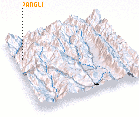 Places with similar names to Pangli, Myanmar ::
Disclaimer :: Information on this page comes without warranty of any kind |
||
|
Where is Pangli? Elevation and coordinates ::
Latitude (lat): 25°45'0"N Longitude (lon): 98°5'0"E
Elevation (approx.): 1301m (map arrows pan, magnifying glasses zoom) |
||
|
Visiting Pangli? Hotel/Accommodation ::
Book a hotel in Pangli Travel Guide ::
Buy a travel guide for Myanmar rental cars ::
car rental offers GPS waypoint ::
download a GPX waypoint (PoI) of Pangli for your GPS receiver
|
||