|
search place name
|
||
Panglong (Shan, Myanmar)Panglong is a town in the Shan region of Myanmar. An overview map of the region around Panglong is displayed below.
regional and 3d topo map of Panglong, Myanmar ::

Panglong airports ::
The nearest airport is LSH - Lashio, located 28.2 km south west of Panglong.
Other airports nearby include KET - Kengtung (263.5 km south east), Nearby towns ::
Panghpa (2.5km north west) //
Namwai (2.5km south east) //
Mān Long (4.1km north east) //
Loi-hseng (3.9km north east) //
Loi-nawk (5.0km south east) //
Mān Loi (5.1km west) //
Hsentaw (5.6km south) //
Loi-pek (5.4km east) //
Pāngmawn (5.4km east) //
Mān Mao (7.4km north) //
Möng Yang (7.4km south) //
Mān Kang (7.6km north) //
Na-nawt (7.6km south) //
Namkat (7.6km south) //
Pangla-lao (7.6km north east) //
Loi-hsa (7.6km north east) //
Kongsong (7.8km south east) //
Na-lao (8.2km south east) //
Loi-pek (8.8km north west) //
Ho-nam (9.0km south west) //
[all distances 'as the bird flies' and approximate] 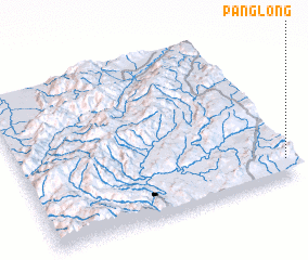 Places with similar names to Panglong, Myanmar ::
Disclaimer :: Information on this page comes without warranty of any kind |
||
|
Where is Panglong? Elevation and coordinates ::
Latitude (lat): 23°7'0"N Longitude (lon): 97°59'0"E
Elevation (approx.): 1340m (map arrows pan, magnifying glasses zoom) |
||
|
Visiting Panglong? Hotel/Accommodation ::
Book a hotel in Panglong Travel Guide ::
Buy a travel guide for Myanmar rental cars ::
car rental offers GPS waypoint ::
download a GPX waypoint (PoI) of Panglong for your GPS receiver
|
||