|
search place name
|
||
Pangpu (Shan, Myanmar)Pangpu is a town in the Shan region of Myanmar. An overview map of the region around Pangpu is displayed below.
regional and 3d topo map of Pangpu, Myanmar ::

Pangpu airports ::
The nearest airport is LSH - Lashio, located 64.1 km south west of Pangpu.
Other airports nearby include KET - Kengtung (260.0 km south east), Nearby towns ::
Loiyang (3.4km west) //
Loi-hseng (3.7km south) //
Loi-hkam (3.7km north) //
Panghpa-mawng (3.4km east) //
Mān Len (3.9km south west) //
Panghpakmöng (3.9km south east) //
Ho-pang (5.0km north east) //
Mān Namman (5.6km south) //
Ho-hsa (5.1km east) //
Ho-tu Mān Kang (5.8km north) //
Mānkao-poktao (5.4km east) //
Loi-san (6.3km north west) //
Mān Ho-loi (6.5km south east) //
Loi-pek (6.3km north east) //
Loi-kang (6.8km west) //
Loi-ma (6.8km west) //
Namhkomhkam (6.8km east) //
Ho-tu (7.4km north) //
Mān Ke-hkang (7.6km south) //
Hsengkiao (7.6km north) //
Mān Hsanhtong (7.6km south west) //
Nawnghkam (7.5km north west) //
Hpa-leng (7.6km south east) //
Nawnghkio (7.8km north east) //
Loi-sawng (8.2km north east) //
Panghkam (8.2km north east) //
Wawla-pong (9.0km south west) //
Mān Lu-hsaw (9.0km south west) //
Tünmöng (9.0km north west) //
[all distances 'as the bird flies' and approximate] 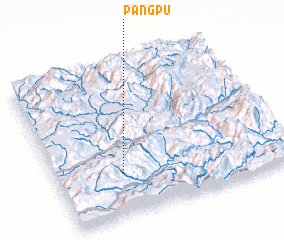 Places with similar names to Pangpu, Myanmar ::
Disclaimer :: Information on this page comes without warranty of any kind |
||
|
Where is Pangpu? Elevation and coordinates ::
Latitude (lat): 23°17'0"N Longitude (lon): 98°17'0"E
Elevation (approx.): 1274m (map arrows pan, magnifying glasses zoom) |
||
|
Visiting Pangpu? Hotel/Accommodation ::
Book a hotel in Pangpu Travel Guide ::
Buy a travel guide for Myanmar rental cars ::
car rental offers GPS waypoint ::
download a GPX waypoint (PoI) of Pangpu for your GPS receiver
|
||