|
search place name
|
||
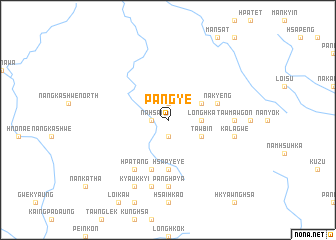
Pangye (Shan, Myanmar)Pangye is a town in the Shan region of Myanmar. An overview map of the region around Pangye is displayed below.
regional and 3d topo map of Pangye, Myanmar ::
Pangye airports ::
The nearest airport is MDL - Mandalay Intl, located 104.1 km south west of Pangye.
Other airports nearby include LSH - Lashio (142.5 km east), HEH - Heho (200.9 km south), Nearby towns ::
Mokhso (1.9km south) //
Nyaungpe (1.9km north) //
Nahsai (1.7km west) //
Longhka (3.4km east) //
Puinwin (3.9km south east) //
Tawbin (3.9km south east) //
Nāhka (3.9km north east) //
Namsaunghu (5.6km south) //
Hsa-pye-ye (5.6km south) //
Nākyeng (5.5km east) //
Namhsa-pye (5.8km south) //
Hpa-tang (6.5km south west) //
Panghpya (7.4km south) //
Tawmawgôn (6.8km east) //
Namhu-leng (7.6km south) //
Kalagwe (7.1km east) //
Namekut (8.2km south west) //
Kyaukkyi (8.2km south west) //
[all distances 'as the bird flies' and approximate] 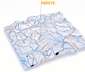 Places with similar names to Pangye, Myanmar ::
Disclaimer :: Information on this page comes without warranty of any kind |
||
|
Where is Pangye? Elevation and coordinates ::
Latitude (lat): 22°32'0"N Longitude (lon): 96°27'0"E
Elevation (approx.): 896m (map arrows pan, magnifying glasses zoom) |
||
|
Visiting Pangye? Hotel/Accommodation ::
Book a hotel in Pangye Travel Guide ::
Buy a travel guide for Myanmar rental cars ::
car rental offers GPS waypoint ::
download a GPX waypoint (PoI) of Pangye for your GPS receiver
|
||