|
search place name
|
||
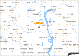
Pawsa-ti (Myanmar)Pawsa-ti is a town in Myanmar. An overview map of the region around Pawsa-ti is displayed below.
regional and 3d topo map of Pawsa-ti, Myanmar ::
Pawsa-ti airports ::
The nearest airport is RGN - Yangon Intl, located 126.6 km south west of Pawsa-ti.
Nearby towns ::
Chaunggyo (2.6km north west) //
Yebawthaung (2.6km north east) //
Yebawthaung Atet (2.6km north east) //
Yebawthaung Auk (2.6km north east) //
Songwè Ashe (3.5km east) //
Hlèzeik (4.0km south west) //
Songon (4.0km south east) //
Kyaungywa (4.0km south east) //
Kada (5.3km west) //
Peingyaung (5.6km east) //
Zibyugon (5.8km north) //
Gyaungta (5.8km south) //
Thaunggyi (5.8km north) //
Tagundaing (5.8km north) //
Salugyaung (5.6km east) //
Saze Kywèdè (6.5km south east) //
Aunggyi Ywathit (7.3km west) //
Sainggwagale (7.7km north west) //
Timugyaung (8.0km south east) //
Ingapaleik (8.2km north west) //
Taungbet (8.2km north east) //
Winkanein (9.1km north east) //
Donzayit (9.0km south east) //
Inchaung (9.1km north west) //
[all distances 'as the bird flies' and approximate] 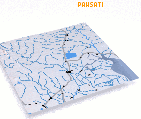 Places with similar names to Pawsa-ti, Myanmar ::
Disclaimer :: Information on this page comes without warranty of any kind |
||
|
Where is Pawsa-ti? Elevation and coordinates ::
Latitude (lat): 17°50'0"N Longitude (lon): 96°50'0"E
Elevation (approx.): 11m (map arrows pan, magnifying glasses zoom) |
||
|
Visiting Pawsa-ti? Hotel/Accommodation ::
Book a hotel in Pawsa-ti Travel Guide ::
Buy a travel guide for Myanmar rental cars ::
car rental offers GPS waypoint ::
download a GPX waypoint (PoI) of Pawsa-ti for your GPS receiver
|
||