|
search place name
|
||
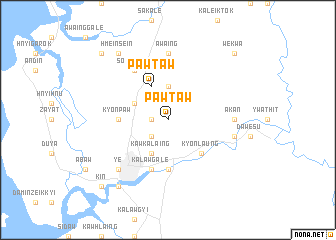
Pawtaw (Myanmar)Pawtaw is a town in Myanmar. An overview map of the region around Pawtaw is displayed below.
regional and 3d topo map of Pawtaw, Myanmar ::
Pawtaw airports ::
The nearest airport is RGN - Yangon Intl, located 259.5 km north west of Pawtaw.
Nearby towns ::
Tumyaung (1.8km west) //
Webaw (2.6km south west) //
Awagyaik (3.7km north) //
Pawtaw (4.1km north west) //
Kawkalaing (4.1km south west) //
Zayat (4.0km north west) //
Kyonlaung (5.2km south east) //
Abok (5.6km south) //
Kyonpaw (5.4km west) //
Kalawgale (5.8km south) //
Sonmatha (6.6km north west) //
Akan (7.2km east) //
Awaing (7.4km north) //
Phagyi (7.4km east) //
Ye (7.7km south west) //
Hmeinsein (9.1km north west) //
Yethanok (9.2km south west) //
Zuntalin (10.3km north west) //
Wekwa (10.3km north east) //
Kin (10.3km south west) //
[all distances 'as the bird flies' and approximate]  Places with similar names to Pawtaw, Myanmar ::
Disclaimer :: Information on this page comes without warranty of any kind |
||
|
Where is Pawtaw? Elevation and coordinates ::
Latitude (lat): 15°18'0"N Longitude (lon): 97°54'0"E
Elevation (approx.): 70m (map arrows pan, magnifying glasses zoom) |
||
|
Visiting Pawtaw? Hotel/Accommodation ::
Book a hotel in Pawtaw Travel Guide ::
Buy a travel guide for Myanmar rental cars ::
car rental offers GPS waypoint ::
download a GPX waypoint (PoI) of Pawtaw for your GPS receiver
|
||