|
search place name
|
||
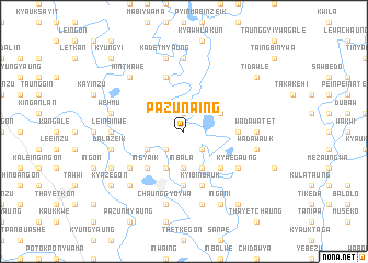
Pazun-aing (Myanmar)Pazun-aing is a town in Myanmar. An overview map of the region around Pazun-aing is displayed below.
regional and 3d topo map of Pazun-aing, Myanmar ::
Pazun-aing airports ::
The nearest airport is RGN - Yangon Intl, located 147.4 km south west of Pazun-aing.
Nearby towns ::
Letkaukwa (1.9km north) //
Inthayan (2.6km south east) //
Thanzeik (2.6km south east) //
Chaunggyo (2.6km south west) //
Inbala (3.7km south) //
Pan-in (4.0km north east) //
Kyauktanbya (4.1km south east) //
Inbala (4.1km south west) //
Mokho Chaunggyi (4.0km south west) //
Kyauktan (5.1km south east) //
Mokho-aukywa (5.1km south west) //
Ingyaik (5.1km south west) //
Minlan-tazeik (5.3km east) //
Pyinyegyi (5.6km south) //
Kyibinbauk (5.8km south) //
Nyaungbinzeik (5.8km north) //
Dalazeik (6.5km south west) //
Kywegaung (6.5km south east) //
Ma-u-in (7.4km north) //
Wadaw-atet (7.0km east) //
Tôthaung (7.0km west) //
Leinbinwe (7.0km west) //
Kadetmyaung (7.6km north) //
Wadaw-auk (7.3km east) //
Wehmu (7.3km west) //
Neyaungga (7.6km south) //
Dalazeik (7.3km west) //
Chaunggyoywa (7.6km south) //
Wainggyun (7.6km south) //
[all distances 'as the bird flies' and approximate] 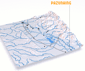 Places with similar names to Pazun-aing, Myanmar ::
Disclaimer :: Information on this page comes without warranty of any kind |
||
|
Where is Pazun-aing? Elevation and coordinates ::
Latitude (lat): 18°4'0"N Longitude (lon): 96°49'0"E
Elevation (approx.): 17m (map arrows pan, magnifying glasses zoom) |
||
|
Visiting Pazun-aing? Hotel/Accommodation ::
Book a hotel in Pazun-aing Travel Guide ::
Buy a travel guide for Myanmar rental cars ::
car rental offers GPS waypoint ::
download a GPX waypoint (PoI) of Pazun-aing for your GPS receiver
|
||