|
search place name
|
||
Phausut (Myanmar)Phausut is a town in Myanmar. An overview map of the region around Phausut is displayed below.
regional and 3d topo map of Phausut, Myanmar ::

Phausut airports ::
The nearest airport is MGZ - Myeik, located 219.0 km north of Phausut.
Other airports nearby include NST - Nakhon Si Thammarat Cha Ian (255.5 km south east), Nearby towns ::
Thonkaprit (0.0km north) //
Marang (1.9km south) //
Nam Noi (2.6km north east) //
Ban Mamu (1) (3.6km east) //
Ban Hin Nong (1) (3.6km east) //
Ban Song Phi Nong Lang (3.6km east) //
Ban Song Phi Nong (4.1km north east) //
Ban Nam Daeng (4.1km south east) //
Ban Bang Sai (4.1km south east) //
Ban Sawa (1) (4.1km south east) //
Ban Don Phlao (4.1km south east) //
Pakchan (5.2km north east) //
Ban Khlong Wan (5.2km north east) //
Nalingchan (5.2km north east) //
Ban Thap Li (5.2km north east) //
Ban Nam Chut Noi (5.6km south) //
Ban Hpap (5.9km north) //
Ban Trokpru (5.9km south) //
Khikafoi (6.6km south west) //
Sai (6.6km south west) //
Ban Kiu (6.6km north east) //
Kra Buri (7.4km south) //
Ban Na Som Poi (7.8km north east) //
Ban Nong Phak Bang (7.8km north east) //
Ban Noi-loi (8.3km north west) //
Hat Fa Hpa (8.3km north east) //
Lumhpaw Noi (8.3km north east) //
Ban Pak Chan (10.4km north east) //
[all distances 'as the bird flies' and approximate] 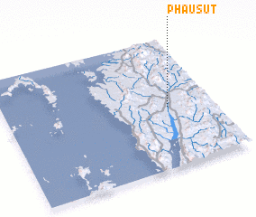 Places with similar names to Phausut, Myanmar ::
Disclaimer :: Information on this page comes without warranty of any kind |
||
|
Where is Phausut? Elevation and coordinates ::
Latitude (lat): 10°28'0"N Longitude (lon): 98°47'0"E
Elevation (approx.): 32m (map arrows pan, magnifying glasses zoom) |
||
|
Visiting Phausut? Hotel/Accommodation ::
Book a hotel in Phausut Travel Guide ::
Buy a travel guide for Myanmar rental cars ::
car rental offers GPS waypoint ::
download a GPX waypoint (PoI) of Phausut for your GPS receiver
|
||