|
search place name
|
||
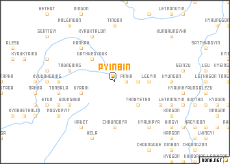
Pyin-bin (Sagaing, Myanmar)Pyin-bin is a town in the Sagaing region of Myanmar. An overview map of the region around Pyin-bin is displayed below.
regional and 3d topo map of Pyin-bin, Myanmar ::
Pyin-bin airports ::
The nearest airport is IMF - Imphal, located 192.6 km north west of Pyin-bin.
Other airports nearby include MYT - Myitkyina (241.8 km north east), Nearby towns ::
Pinka (1.7km east) //
Ywathitkon (1.7km east) //
Mangin (3.4km east) //
Thabyetha (5.0km south east) //
Dathwegyauk (5.0km north west) //
Legyin (5.1km east) //
Kya-aik (5.4km west) //
Chaungbya (7.4km south) //
Tadagaing (7.0km west) //
Mankaw (7.5km north west) //
Sun-pa (7.7km south east) //
Gaungbwa (7.7km south west) //
Kyauktalon (8.2km north west) //
Kadet (9.0km south west) //
Kyaukpya (9.0km south east) //
[all distances 'as the bird flies' and approximate] 
Disclaimer :: Information on this page comes without warranty of any kind |
||
|
Where is Pyin-bin? Elevation and coordinates ::
Latitude (lat): 23°56'0"N Longitude (lon): 95°34'0"E
Elevation (approx.): 418m (map arrows pan, magnifying glasses zoom) |
||
|
Visiting Pyin-bin? Hotel/Accommodation ::
Book a hotel in Pyin-bin Travel Guide ::
Buy a travel guide for Myanmar rental cars ::
car rental offers GPS waypoint ::
download a GPX waypoint (PoI) of Pyin-bin for your GPS receiver
|
||