|
search place name
|
||
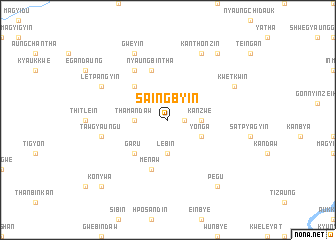
Saingbyin (Sagaing, Myanmar)Saingbyin is a town in the Sagaing region of Myanmar. An overview map of the region around Saingbyin is displayed below.
regional and 3d topo map of Saingbyin, Myanmar ::
Saingbyin airports ::
The nearest airport is MDL - Mandalay Intl, located 64.0 km south east of Saingbyin.
Other airports nearby include HEH - Heho (198.1 km south east), Nearby towns ::
Nyaungbingan (1.7km east) //
Hle-u-gan (1.7km east) //
Thamandaw (3.4km west) //
Pyinzagon (3.7km south) //
Lèbin (3.7km south) //
Kanzwè (3.4km east) //
Yonga (3.9km south east) //
Padattaing (5.1km north west) //
Garu (5.1km south west) //
Nyaungbintha (5.8km north) //
Me-naw (5.8km south) //
Maletha (6.5km north west) //
Tawgyaung-u (7.1km west) //
Letpangyin (7.8km north west) //
Gweyin (8.2km north west) //
Kwetkwin (7.8km north east) //
Kanthonzin (8.2km north east) //
Pegu (9.0km south east) //
Ngakin (9.0km north east) //
Konywa (10.1km south west) //
[all distances 'as the bird flies' and approximate] 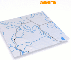 Places with similar names to Saingbyin, Myanmar ::
Disclaimer :: Information on this page comes without warranty of any kind |
||
|
Where is Saingbyin? Elevation and coordinates ::
Latitude (lat): 22°3'0"N Longitude (lon): 95°29'0"E
Elevation (approx.): 136m (map arrows pan, magnifying glasses zoom) |
||
|
Visiting Saingbyin? Hotel/Accommodation ::
Book a hotel in Saingbyin Travel Guide ::
Buy a travel guide for Myanmar rental cars ::
car rental offers GPS waypoint ::
download a GPX waypoint (PoI) of Saingbyin for your GPS receiver
|
||