|
search place name
|
||
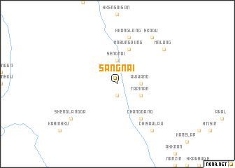
Sangnai (Kachin State, Myanmar)Sangnai is a town in the Kachin State region of Myanmar. An overview map of the region around Sangnai is displayed below.
regional and 3d topo map of Sangnai, Myanmar ::
Sangnai airports ::
The nearest airport is PBU - Putao, located 68.3 km west of Sangnai.
Nearby towns ::
Tinggam (1.9km south) //
Sengnai (3.7km north) //
Awiwang (3.3km east) //
Tarinam (3.8km south east) //
Mabungawng (5.8km north) //
Changdang (6.5km south east) //
Hkonglāng (7.6km north) //
Hkadu (8.9km north east) //
Malong (8.6km north east) //
Shenglang Ga (8.6km south west) //
Segim (8.9km south east) //
Chisawlaw (8.9km south east) //
[all distances 'as the bird flies' and approximate]  Places with similar names to Sangnai, Myanmar ::
Disclaimer :: Information on this page comes without warranty of any kind |
||
|
Where is Sangnai? Elevation and coordinates ::
Latitude (lat): 27°28'0"N Longitude (lon): 98°6'0"E
Elevation (approx.): 924m (map arrows pan, magnifying glasses zoom) |
||
|
Visiting Sangnai? Hotel/Accommodation ::
Book a hotel in Sangnai Travel Guide ::
Buy a travel guide for Myanmar rental cars ::
car rental offers GPS waypoint ::
download a GPX waypoint (PoI) of Sangnai for your GPS receiver
|
||