|
search place name
|
||
Sangphyet (Shan, Myanmar)Sangphyet is a town in the Shan region of Myanmar. An overview map of the region around Sangphyet is displayed below.
regional and 3d topo map of Sangphyet, Myanmar ::

Sangphyet airports ::
The nearest airport is LSH - Lashio, located 18.3 km north east of Sangphyet.
Other airports nearby include MDL - Mandalay Intl (214.4 km south west), KET - Kengtung (264.7 km south east), Nearby towns ::
Kio-mi (1.7km west) //
Kong-nio (2.5km south east) //
Khe-nim (2.5km south west) //
Loi-hy (3.4km west) //
Nam-pok (4.1km south east) //
Nam-hpat (3.9km south west) //
Loi-lawm (4.1km north east) //
Mān-pang (5.0km south east) //
Nam-hsan (5.0km south east) //
Ho-nā (5.0km north west) //
Mān-māk-lāng (5.1km west) //
Nam-maw-som (5.6km north) //
Nam-un (5.1km east) //
Ho-nā (5.8km south) //
Nawngmawn (5.8km south) //
Nam-hpuk-tok (5.8km south) //
Pa-hki (6.3km south west) //
Pangyao (6.5km north east) //
Pangmakhe-leng (6.5km south east) //
Mè-han (6.5km north east) //
Nam-lük (6.5km south east) //
Hpa-ye (6.3km south east) //
Mān-kao-lone (6.5km north west) //
Nawng-hpau (6.5km north west) //
Mān-pong (6.3km north west) //
Hseing-hkai (6.3km north west) //
Lük-le (6.3km north east) //
Mān Pwe (7.1km west) //
Nā-hpot (7.6km south west) //
[all distances 'as the bird flies' and approximate] 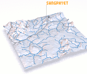 Places with similar names to Sangphyet, Myanmar ::
// Xingfuyidui (CN)
Disclaimer :: Information on this page comes without warranty of any kind |
||
|
Where is Sangphyet? Elevation and coordinates ::
Latitude (lat): 22°50'0"N Longitude (lon): 97°40'0"E
Elevation (approx.): 960m (map arrows pan, magnifying glasses zoom) |
||
|
Visiting Sangphyet? Hotel/Accommodation ::
Book a hotel in Sangphyet Travel Guide ::
Buy a travel guide for Myanmar rental cars ::
car rental offers GPS waypoint ::
download a GPX waypoint (PoI) of Sangphyet for your GPS receiver
|
||