|
search place name
|
||
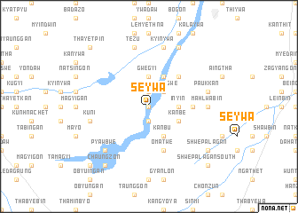
Seywa (Mandalay, Myanmar)Seywa is a town in the Mandalay region of Myanmar. An overview map of the region around Seywa is displayed below.
regional and 3d topo map of Seywa, Myanmar ::
Seywa airports ::
The nearest airport is MDL - Mandalay Intl, located 69.5 km north of Seywa.
Other airports nearby include HEH - Heho (103.2 km east), LSH - Lashio (286.2 km north east), Nearby towns ::
Kongan (0.0km north) //
Kyaunggon (1.9km south) //
Mondaw (1.9km north) //
Sinthegwe (2.5km north east) //
Inyin (3.5km east) //
Palangyin (3.7km north) //
Thapanbin (3.7km north) //
Gwegyi (3.7km north) //
Shauktaw (3.7km north) //
Palawa (3.7km north) //
Kanbu (4.1km south east) //
Yeaung (3.9km south east) //
Kanbe (3.9km south east) //
Nyaunggan (4.1km north east) //
Nyaungkaya (4.1km north east) //
Thitpalwegan (5.1km north east) //
Thedaw (5.2km east) //
Omatwe (5.8km south) //
Mahlwabin (6.9km east) //
Paukkan (7.2km east) //
Kuni (7.2km west) //
Kyinywa (7.6km north) //
Tezu (7.6km north) //
Pyawbwe (7.6km south west) //
Shanzu (8.2km north east) //
Chaungzon (9.0km south west) //
Shwepalagan (8.9km south east) //
Shwepalagan North (8.9km south east) //
Shwepalagan South (10.1km south east) //
[all distances 'as the bird flies' and approximate] 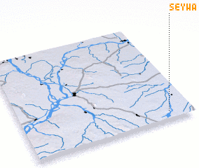 Places with similar names to Seywa, Myanmar ::
Disclaimer :: Information on this page comes without warranty of any kind |
||
|
Where is Seywa? Elevation and coordinates ::
Latitude (lat): 21°5'0"N Longitude (lon): 95°52'0"E
Elevation (approx.): 183m (map arrows pan, magnifying glasses zoom) |
||
|
Visiting Seywa? Hotel/Accommodation ::
Book a hotel in Seywa Travel Guide ::
Buy a travel guide for Myanmar rental cars ::
car rental offers GPS waypoint ::
download a GPX waypoint (PoI) of Seywa for your GPS receiver
|
||