|
search place name
|
||
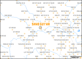
Shweguywa (Myanmar)Shweguywa is a town in Myanmar. An overview map of the region around Shweguywa is displayed below.
regional and 3d topo map of Shweguywa, Myanmar ::
Shweguywa airports ::
The nearest airport is HEH - Heho, located 206.5 km north of Shweguywa.
Nearby towns ::
Pabewa (NaNkm north) //
Shanzu (1.8km east) //
Kanbaukkyi (1.9km north) //
Kyettaiknyaungbin (2.6km south west) //
Pyezo-in (2.6km north west) //
Myinsakhwet (2.6km north east) //
Mweyo (2.6km north east) //
Shanywa (3.5km west) //
Thada (4.0km south west) //
Bogon (4.0km south west) //
We-gyi (4.0km south east) //
Thayagon (4.0km north east) //
Bokadaw (4.1km north east) //
Shwelaung (5.1km south west) //
Kyu-in (5.1km north west) //
Htangon (5.1km north east) //
Myaungyochaung (5.1km north east) //
Sawbwa (5.3km east) //
Payahnazu (5.3km east) //
Sinzeik (5.3km east) //
Kabani (5.3km west) //
Kinnge (5.8km north) //
Hinyemya (5.8km north) //
Sabagywe (5.6km west) //
Yeni (6.4km south east) //
Thayetpin (6.6km north east) //
Inde (6.4km north east) //
Magyigon (6.4km north east) //
Yeshan (7.4km south) //
[all distances 'as the bird flies' and approximate] 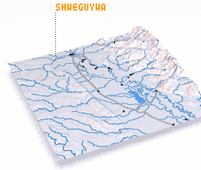 Places with similar names to Shweguywa, Myanmar ::
Disclaimer :: Information on this page comes without warranty of any kind |
||
|
Where is Shweguywa? Elevation and coordinates ::
Latitude (lat): 18°56'0"N Longitude (lon): 96°20'0"E
Elevation (approx.): 56m (map arrows pan, magnifying glasses zoom) |
||
|
Visiting Shweguywa? Hotel/Accommodation ::
Book a hotel in Shweguywa Travel Guide ::
Buy a travel guide for Myanmar rental cars ::
car rental offers GPS waypoint ::
download a GPX waypoint (PoI) of Shweguywa for your GPS receiver
|
||