|
search place name
|
||
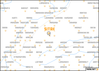
Si-tak (Shan, Myanmar)Si-tak is a town in the Shan region of Myanmar. An overview map of the region around Si-tak is displayed below.
regional and 3d topo map of Si-tak, Myanmar ::
Si-tak airports ::
The nearest airport is LSH - Lashio, located 110.5 km north of Si-tak.
Other airports nearby include HEH - Heho (184.6 km south west), KET - Kengtung (189.3 km south east), MDL - Mandalay Intl (208.2 km west), MOG - Mong Hsat (211.9 km south east), Nearby towns ::
Panghsè-hpak (0.0km north) //
Loi-yoi (1.7km east) //
Pāngpok (2.5km north east) //
Tekhun (2.5km south west) //
Namtēk (2.5km south west) //
Namhawk (2.5km north west) //
Wān Hkan (3.7km south) //
Pāngpok (4.1km north east) //
Mān Kyawng (4.1km north west) //
Wān Kyawng (5.1km south east) //
Pāng Sè (5.1km south west) //
Loi-hsang (5.6km north) //
Ha-wan (5.6km south) //
Man Kongnyawng (5.6km north) //
Wan Kat-ping (5.6km south) //
Wān Hwè (5.8km south) //
Tonhsan (5.5km west) //
Nawnghwi (5.5km west) //
Wān Nim (6.3km south east) //
Loi-hkaw (6.5km north east) //
Nam-ta-lawn (6.3km south west) //
Namkat (6.3km north west) //
Mān Hpwa (6.9km west) //
Mān Wap (7.6km north) //
Hpa-law (7.1km west) //
Namhkai-kongsong (7.6km north) //
Pangmöng (7.6km south) //
Kongnawt (7.6km south east) //
Kongkam (7.6km south east) //
[all distances 'as the bird flies' and approximate] 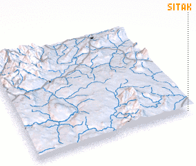 Places with similar names to Si-tak, Myanmar ::
Disclaimer :: Information on this page comes without warranty of any kind |
||
|
Where is Si-tak? Elevation and coordinates ::
Latitude (lat): 22°0'0"N Longitude (lon): 97°58'0"E
Elevation (approx.): 920m (map arrows pan, magnifying glasses zoom) |
||
|
Visiting Si-tak? Hotel/Accommodation ::
Book a hotel in Si-tak Travel Guide ::
Buy a travel guide for Myanmar rental cars ::
car rental offers GPS waypoint ::
download a GPX waypoint (PoI) of Si-tak for your GPS receiver
|
||