|
search place name
|
||
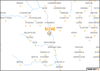
Sizwe (Shan, Myanmar)Sizwe is a town in the Shan region of Myanmar. An overview map of the region around Sizwe is displayed below.
regional and 3d topo map of Sizwe, Myanmar ::
Sizwe airports ::
The nearest airport is HEH - Heho, located 73.1 km north of Sizwe.
Other airports nearby include MDL - Mandalay Intl (186.5 km north), Nearby towns ::
Sahpyin (3.7km north) //
Kyawbadu (3.7km north) //
Nanzinbauk (3.7km south) //
Nan-aw (3.9km north east) //
Lwedan (5.1km north west) //
Shweda (5.8km south) //
Shweda Myauk (5.8km south) //
Yezo (6.4km south west) //
Molamyaing (7.0km west) //
Tatkon (7.2km west) //
Taunggya (7.6km south) //
Nanzitke (7.6km south) //
Kyauktin (7.6km north east) //
Thitsedaung (7.6km north west) //
Htagauk (7.9km north west) //
Tabaung (9.1km north east) //
Sizongon (10.2km north west) //
Sapbo (10.2km north east) //
[all distances 'as the bird flies' and approximate] 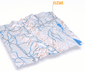 Places with similar names to Sizwe, Myanmar ::
Disclaimer :: Information on this page comes without warranty of any kind |
||
|
Where is Sizwe? Elevation and coordinates ::
Latitude (lat): 20°7'0"N Longitude (lon): 96°35'0"E
Elevation (approx.): 404m (map arrows pan, magnifying glasses zoom) |
||
|
Visiting Sizwe? Hotel/Accommodation ::
Book a hotel in Sizwe Travel Guide ::
Buy a travel guide for Myanmar rental cars ::
car rental offers GPS waypoint ::
download a GPX waypoint (PoI) of Sizwe for your GPS receiver
|
||