|
search place name
|
||
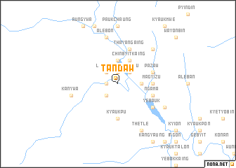
Tandaw (Myanmar)Tandaw is a town in Myanmar. An overview map of the region around Tandaw is displayed below.
regional and 3d topo map of Tandaw, Myanmar ::
Tandaw airports ::
The nearest airport is KYP - Kyaukpyu, located 134.3 km south west of Tandaw.
Other airports nearby include AKY - Sittwe (147.7 km west), SNW - Thandwe (218.4 km south), MDL - Mandalay Intl (228.0 km north east), Nearby towns ::
Auk-pôngôn (1.9km north) //
Sidoktaya (1.9km north) //
Ywathit (1.9km north) //
Madein (1.7km west) //
Tinbaing (2.5km south west) //
Nyaung-aing (2.5km north east) //
Letpyin (2.5km north west) //
Lèbyinzu (2.5km north east) //
Myenigôn (3.5km east) //
Aukpôn (3.7km north) //
Chinbyitkaing (4.1km north east) //
Magyizu (5.2km east) //
Kyaukpu (5.6km south) //
Myenidaung (5.5km east) //
Ngama (5.5km east) //
Pazaw (5.5km east) //
Thayangaing (5.8km north) //
Yebauk (6.4km south east) //
Kanywa (7.2km west) //
Alebôn (7.6km north) //
Pazawbya (7.6km north east) //
Thetle (8.2km south east) //
Thanze (7.9km south east) //
[all distances 'as the bird flies' and approximate] 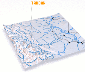 Places with similar names to Tandaw, Myanmar ::
Disclaimer :: Information on this page comes without warranty of any kind |
||
|
Where is Tandaw? Elevation and coordinates ::
Latitude (lat): 20°26'0"N Longitude (lon): 94°15'0"E
Elevation (approx.): 119m (map arrows pan, magnifying glasses zoom) |
||
|
Visiting Tandaw? Hotel/Accommodation ::
Book a hotel in Tandaw Travel Guide ::
Buy a travel guide for Myanmar rental cars ::
car rental offers GPS waypoint ::
download a GPX waypoint (PoI) of Tandaw for your GPS receiver
|
||