|
search place name
|
||
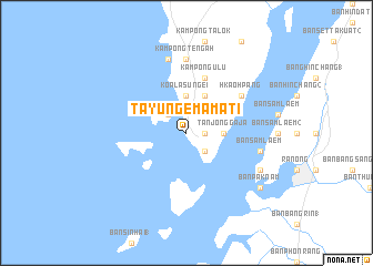
Tayung Emamati (Myanmar)Tayung Emamati is a town in Myanmar. An overview map of the region around Tayung Emamati is displayed below.
regional and 3d topo map of Tayung Emamati, Myanmar ::
Tayung Emamati airports ::
The nearest airport is HKT - Phuket Intl, located 210.0 km south of Tayung Emamati.
Other airports nearby include NST - Nakhon Si Thammarat Cha Ian (230.3 km south east), Nearby towns ::
Banhasri (1.8km east) //
Talo Kalubi (2.6km north west) //
Kawthoung (2.6km south east) //
Koala Sungēi (3.7km north) //
Tanjong Gaja (3.7km east) //
Kampong Lama (4.1km north east) //
Kampong Ulu (5.9km north) //
Pakklōhng (6.6km north east) //
Hkaohpang (6.6km north east) //
Kampong Tengah (7.4km north) //
Kampong Chena (7.6km north) //
Ban Sam Laem (7.5km east) //
Ban Khon Tham Rai (8.2km south east) //
Ban Pak Nam (9.2km south east) //
[all distances 'as the bird flies' and approximate] 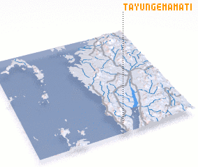 Places with similar names to Tayung Emamati, Myanmar :: Disclaimer :: Information on this page comes without warranty of any kind |
||
|
Where is Tayung Emamati? Elevation and coordinates ::
Latitude (lat): 10°0'0"N Longitude (lon): 98°32'0"E
(map arrows pan, magnifying glasses zoom) |
||
|
Visiting Tayung Emamati? Hotel/Accommodation ::
Book a hotel in Tayung Emamati Travel Guide ::
Buy a travel guide for Myanmar rental cars ::
car rental offers GPS waypoint ::
download a GPX waypoint (PoI) of Tayung Emamati for your GPS receiver
|
||