|
search place name
|
||
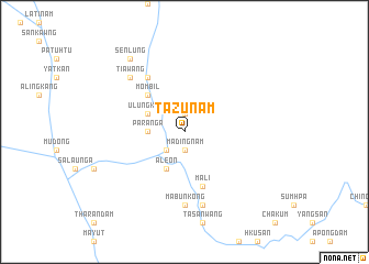
Tazunam (Kachin State, Myanmar)Tazunam is a town in the Kachin State region of Myanmar. An overview map of the region around Tazunam is displayed below.
regional and 3d topo map of Tazunam, Myanmar ::
Tazunam airports ::
The nearest airport is PBU - Putao, located 82.9 km south west of Tazunam.
Nearby towns ::
Madingnam (1.9km south) //
Zinam (1.9km north) //
Wangchindam (2.5km south west) //
Paranga (3.3km west) //
Alē-on (4.1km south west) //
Ulungkong (3.8km north west) //
Mombil (4.9km north west) //
Mali (5.8km south) //
Maisan (6.5km north west) //
Mabunkong (7.4km south) //
Mayut (7.6km south) //
Tiawang (7.4km north west) //
Senlung (8.9km north west) //
[all distances 'as the bird flies' and approximate] 
Disclaimer :: Information on this page comes without warranty of any kind |
||
|
Where is Tazunam? Elevation and coordinates ::
Latitude (lat): 27°44'0"N Longitude (lon): 98°8'0"E
Elevation (approx.): 1682m (map arrows pan, magnifying glasses zoom) |
||
|
Visiting Tazunam? Hotel/Accommodation ::
Book a hotel in Tazunam Travel Guide ::
Buy a travel guide for Myanmar rental cars ::
car rental offers GPS waypoint ::
download a GPX waypoint (PoI) of Tazunam for your GPS receiver
|
||