|
search place name
|
||
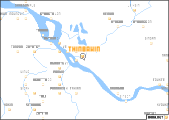
Thinbawin (Kachin State, Myanmar)Thinbawin is a town in the Kachin State region of Myanmar. An overview map of the region around Thinbawin is displayed below.
regional and 3d topo map of Thinbawin, Myanmar ::
Thinbawin airports ::
The nearest airport is MYT - Myitkyina, located 140.6 km north of Thinbawin.
Other airports nearby include LSH - Lashio (163.7 km south east), Nearby towns ::
Kyundaw (1.7km west) //
Mosit (2.5km north west) //
Yele (3.9km north west) //
Ngabatgyi (5.4km west) //
Shwegu (5.4km west) //
Pandin (6.3km south west) //
Sindat (6.3km north west) //
Tawian (7.6km south) //
Myaingtha (7.5km south west) //
Tugyaung (7.7km north west) //
Pinmahkaw (9.0km south west) //
Myogôn (10.0km north east) //
Naungmo (10.0km south east) //
[all distances 'as the bird flies' and approximate] 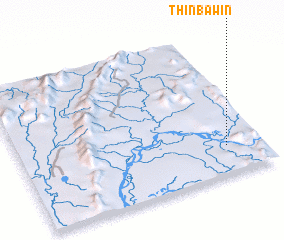 Places with similar names to Thinbawin, Myanmar :: Disclaimer :: Information on this page comes without warranty of any kind |
||
|
Where is Thinbawin? Elevation and coordinates ::
Latitude (lat): 24°12'0"N Longitude (lon): 96°51'0"E
Elevation (approx.): 103m (map arrows pan, magnifying glasses zoom) |
||
|
Visiting Thinbawin? Hotel/Accommodation ::
Book a hotel in Thinbawin Travel Guide ::
Buy a travel guide for Myanmar rental cars ::
car rental offers GPS waypoint ::
download a GPX waypoint (PoI) of Thinbawin for your GPS receiver
|
||