|
search place name
|
||
Tunhok (Shan, Myanmar)Tunhok is a town in the Shan region of Myanmar. An overview map of the region around Tunhok is displayed below.
regional and 3d topo map of Tunhok, Myanmar ::

Tunhok airports ::
The nearest airport is HEH - Heho, located 82.6 km west of Tunhok.
Other airports nearby include MOG - Mong Hsat (175.6 km east), MDL - Mandalay Intl (200.2 km north west), Nearby towns ::
Wān Li (NaNkm north) //
Hwekonghsai (2.5km north west) //
Wān Kang (3.7km south) //
Hoyang (3.5km west) //
Hsamhseng (4.1km north east) //
Sanghkam (3.9km south west) //
Kongkyawng (3.9km north west) //
Namtawng (3.9km north west) //
Wān Loi-hsau (3.9km south east) //
Nammawhsum (3.9km south east) //
Tunkeng (5.1km south west) //
Lawkna (5.1km south east) //
Kangtang (5.8km south) //
Wānhainalong (5.5km east) //
Pangkullaklai (5.5km east) //
Taklet (6.4km south west) //
Wānmau (6.4km north west) //
Nawngleng (6.6km north east) //
Wān Mau (7.4km north) //
Möng Sit (7.4km south) //
Kawngyau (7.2km west) //
Wān Heng (7.6km south) //
Ho-ma (7.6km north) //
Hai-hsang (7.2km east) //
Wānyan (7.6km south west) //
Namkak (7.9km north west) //
Wān Loi-ma (8.9km south west) //
Nammang (8.9km north east) //
Wanloiyehkau (10.2km south west) //
[all distances 'as the bird flies' and approximate] 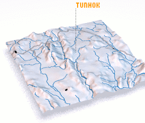 Places with similar names to Tunhok, Myanmar ::
// Tonhéque (MZ)
// Tunuhugu (PG)
// Tanhaçu (BR)
// Tonhök (MM)
// Tunhok (MM)
// Tân Hóa (2) (VN)
// Tiêu Nhược (VN)
// Ton Hac (VN)
// Tanhekou (CN)
// Den Hoek (BE)
Disclaimer :: Information on this page comes without warranty of any kind |
||
|
Where is Tunhok? Elevation and coordinates ::
Latitude (lat): 20°42'0"N Longitude (lon): 97°35'0"E
Elevation (approx.): 1003m (map arrows pan, magnifying glasses zoom) |
||
|
Visiting Tunhok? Hotel/Accommodation ::
Book a hotel in Tunhok Travel Guide ::
Buy a travel guide for Myanmar rental cars ::
car rental offers GPS waypoint ::
download a GPX waypoint (PoI) of Tunhok for your GPS receiver
|
||