|
search place name
|
||
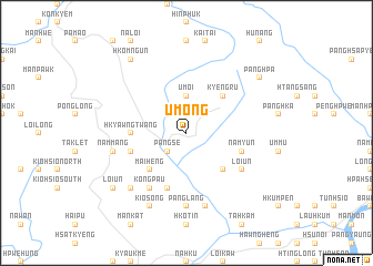
Umöng (Shan, Myanmar)Umöng is a town in the Shan region of Myanmar. An overview map of the region around Umöng is displayed below.
regional and 3d topo map of Umöng, Myanmar ::
Umöng airports ::
The nearest airport is LSH - Lashio, located 77.7 km north east of Umöng.
Other airports nearby include MDL - Mandalay Intl (155.0 km south west), HEH - Heho (212.9 km south), Nearby towns ::
Kunkaw (1.9km north) //
Tao-hpai (1.9km north) //
Pāngse (2.5km south west) //
Um-oi (3.7km north) //
Maiheng (5.0km south west) //
Könglāng (5.0km south east) //
Kyengru (5.0km north east) //
Hkyawngtwang (5.1km west) //
Namhpa (5.8km south) //
Namyün (5.5km east) //
Mānna (5.5km west) //
Loi-un (6.3km south east) //
Köngpau (6.5km south west) //
Pānglāng (7.4km south) //
Nammang (7.1km west) //
Namlin (7.6km south) //
Mān-aw (7.6km south west) //
Kiosöng (8.2km south west) //
Loi-un (8.8km south west) //
Panghpa (8.8km north east) //
Hkömngün (9.0km north west) //
[all distances 'as the bird flies' and approximate] 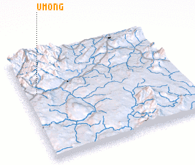 Places with similar names to Umöng, Myanmar ::
Disclaimer :: Information on this page comes without warranty of any kind |
||
|
Where is Umöng? Elevation and coordinates ::
Latitude (lat): 22°39'0"N Longitude (lon): 97°5'0"E
Elevation (approx.): 1016m (map arrows pan, magnifying glasses zoom) |
||
|
Visiting Umöng? Hotel/Accommodation ::
Book a hotel in Umöng Travel Guide ::
Buy a travel guide for Myanmar rental cars ::
car rental offers GPS waypoint ::
download a GPX waypoint (PoI) of Umöng for your GPS receiver
|
||