|
search place name
|
||
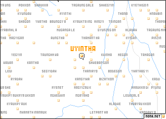
Uyintha (Sagaing, Myanmar)Uyintha is a town in the Sagaing region of Myanmar. An overview map of the region around Uyintha is displayed below.
regional and 3d topo map of Uyintha, Myanmar ::
Uyintha airports ::
The nearest airport is MDL - Mandalay Intl, located 80.9 km south east of Uyintha.
Other airports nearby include HEH - Heho (215.7 km south east), Nearby towns ::
Tedaw (1.9km south) //
Wetke (1.7km west) //
Mugyo (1.7km west) //
Kanzegon (1.7km east) //
Kywepagan (2.5km south west) //
Dondit (2.5km south west) //
Taungdawgon (2.5km north east) //
Thaniayo (4.1km south east) //
Shwebangon (3.9km south east) //
Thamantha (4.1km north east) //
Swègwe (5.0km north west) //
Kwinma (5.1km east) //
Kadogon (5.6km south) //
Kangyiwa (5.6km south) //
Zayit (5.8km south) //
Bodegon (5.8km north) //
Mugangale (6.5km north west) //
Shwe-o-gya (6.5km south east) //
Aungtha (6.3km north west) //
Magyizauk (7.4km south) //
Taunghmwa (6.9km west) //
Kyauktaing (7.4km north) //
Nabehla (7.6km south) //
Bizatkon (7.6km south east) //
Gyunzegon (7.6km north east) //
Segyidaw (7.8km south west) //
Bodègon (7.8km south east) //
Mingyi (8.2km north east) //
Myenet (9.0km south west) //
[all distances 'as the bird flies' and approximate] 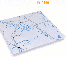
Disclaimer :: Information on this page comes without warranty of any kind |
||
|
Where is Uyintha? Elevation and coordinates ::
Latitude (lat): 22°20'0"N Longitude (lon): 95°35'0"E
Elevation (approx.): 82m (map arrows pan, magnifying glasses zoom) |
||
|
Visiting Uyintha? Hotel/Accommodation ::
Book a hotel in Uyintha Travel Guide ::
Buy a travel guide for Myanmar rental cars ::
car rental offers GPS waypoint ::
download a GPX waypoint (PoI) of Uyintha for your GPS receiver
|
||