|
search place name
|
||
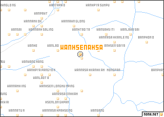
Wān Hsen-a-hsa (Shan, Myanmar)Wān Hsen-a-hsa is a town in the Shan region of Myanmar. An overview map of the region around Wān Hsen-a-hsa is displayed below.
regional and 3d topo map of Wān Hsen-a-hsa, Myanmar ::
Wān Hsen-a-hsa airports ::
The nearest airport is KET - Kengtung, located 102.2 km west of Wān Hsen-a-hsa.
Other airports nearby include THL - Tachilek Tachileik (107.8 km south west), MOG - Mong Hsat (161.3 km south west), LPQ - Luang Prabang Luang Phabang Intl (217.3 km south east), Nearby towns ::
Wān Hsenhkamsao (0.0km north) //
Wān Lao-yāng (0.0km north) //
Wān Hsenhkamlü (3.9km north east) //
Wān Ra-sa-hkanhkam (4.1km south east) //
Wān Hsenhpa-hseng (4.1km south east) //
Wān Htao-ta (5.6km north) //
Wān Lao-fūng (5.5km west) //
Wān Hsenhpa-hkam (7.4km south) //
Wān Hsen Sai-yā (7.2km east) //
Wān Nawnglōng (7.6km north) //
Wān Sa-hsi-ti (7.6km north east) //
Wān Ra-sa-hkamleng (7.8km north east) //
Wān Kawng (7.8km south east) //
Möng Fan (7.8km south east) //
Wān Hpya-khün (7.8km south west) //
Wān Hsenlōngmūnping (9.0km south west) //
[all distances 'as the bird flies' and approximate] 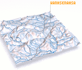 Places with similar names to Wān Hsen-a-hsa, Myanmar ::
// Wān Hsenhsai (MM)
// Wān Hsinsai (MM)
// Wān Hsensai (MM)
// Wān Hsen-a-hsa (MM)
// Wān Hsensai (MM)
// Wān Hsensai (MM)
// Wān Hsensai (MM)
// Wān Hsensai (MM)
// Wān Hsenzai (MM)
// Wancennes (BE)
Disclaimer :: Information on this page comes without warranty of any kind |
||
|
Where is Wān Hsen-a-hsa? Elevation and coordinates ::
Latitude (lat): 21°13'0"N Longitude (lon): 100°37'0"E
Elevation (approx.): 863m (map arrows pan, magnifying glasses zoom) |
||
|
Visiting Wān Hsen-a-hsa? Hotel/Accommodation ::
Book a hotel in Wān Hsen-a-hsa Travel Guide ::
Buy a travel guide for Myanmar rental cars ::
car rental offers GPS waypoint ::
download a GPX waypoint (PoI) of Wān Hsen-a-hsa for your GPS receiver
|
||