|
search place name
|
||
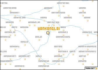
Wān Kanglai (Shan, Myanmar)Wān Kanglai is a town in the Shan region of Myanmar. An overview map of the region around Wān Kanglai is displayed below.
regional and 3d topo map of Wān Kanglai, Myanmar ::
Wān Kanglai airports ::
The nearest airport is KET - Kengtung, located 36.7 km west of Wān Kanglai.
Other airports nearby include THL - Tachilek Tachileik (97.9 km south), MOG - Mong Hsat (120.7 km south west), Nearby towns ::
Wān Yaklang (1.9km north) //
Wān Ngye (2.5km north east) //
Wān Nōk (3.7km north) //
Wān Pang-yūng (3.9km north west) //
Wān Lūk (3.9km south west) //
Wān Yaklang (4.1km north east) //
Wān Kawng (5.2km east) //
Wān Ku (5.5km east) //
Wān Piu (5.8km north) //
Wān Pangkawng (5.5km east) //
Wān Mawnlan (6.4km north west) //
Wān Yang (6.5km south east) //
Namlin (7.8km north west) //
Wān Ta-pangnoi (8.2km north east) //
Wān Ta-panglōng (8.2km north east) //
Wān Nawnghkam (8.2km north east) //
Wān Kyen (8.2km north east) //
Wān Sawn (8.2km south east) //
Wān Ta-san (9.0km south east) //
Wān Māng (8.9km north east) //
Wān Raw (10.1km north east) //
[all distances 'as the bird flies' and approximate] 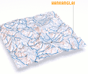 Places with similar names to Wān Kanglai, Myanmar ::
// Wangŭng-gol (KP)
// Wān Konglio (MM)
Disclaimer :: Information on this page comes without warranty of any kind |
||
|
Where is Wān Kanglai? Elevation and coordinates ::
Latitude (lat): 21°22'0"N Longitude (lon): 99°59'0"E
Elevation (approx.): 1341m (map arrows pan, magnifying glasses zoom) |
||
|
Visiting Wān Kanglai? Hotel/Accommodation ::
Book a hotel in Wān Kanglai Travel Guide ::
Buy a travel guide for Myanmar rental cars ::
car rental offers GPS waypoint ::
download a GPX waypoint (PoI) of Wān Kanglai for your GPS receiver
|
||