|
search place name
|
||
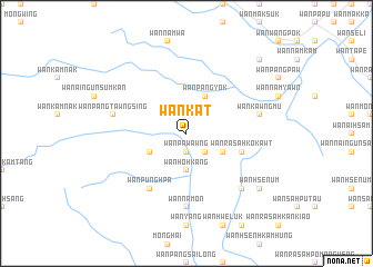
Wān Kāt (Shan, Myanmar)Wān Kāt is a town in the Shan region of Myanmar. An overview map of the region around Wān Kāt is displayed below.
regional and 3d topo map of Wān Kāt, Myanmar ::
Wān Kāt airports ::
The nearest airport is THL - Tachilek Tachileik, located 35.4 km south of Wān Kāt.
Other airports nearby include KET - Kengtung (60.4 km north), MOG - Mong Hsat (65.4 km south west), Nearby towns ::
Wān Pā-wawng (1.9km south) //
Möng Hai (1.9km south) //
Wān Tūnglöng (2.5km south east) //
Wān Ho-hkang (3.7km south) //
Wān Makhkö-pa-hkā (3.9km south east) //
Wān Pangyök (4.1km north east) //
Wān Pangnö (3.9km south west) //
Wān Ra-sa-hkö-kawt (5.5km east) //
Wān Pūnghpa (6.6km south west) //
Wān Na-mōn (7.4km south) //
Wān Kawngmu (7.2km east) //
Wān Pangtawngsing (7.2km west) //
Wān Hsenhkamwat (7.6km south east) //
Wān Hsen-üm (8.9km south east) //
Wān Hsenhkam-yawt (8.9km south east) //
Wān Hwè-hōk (10.1km north east) //
[all distances 'as the bird flies' and approximate]  Places with similar names to Wān Kāt, Myanmar ::
Disclaimer :: Information on this page comes without warranty of any kind |
||
|
Where is Wān Kāt? Elevation and coordinates ::
Latitude (lat): 20°47'0"N Longitude (lon): 99°49'0"E
Elevation (approx.): 556m (map arrows pan, magnifying glasses zoom) |
||
|
Visiting Wān Kāt? Hotel/Accommodation ::
Book a hotel in Wān Kāt Travel Guide ::
Buy a travel guide for Myanmar rental cars ::
car rental offers GPS waypoint ::
download a GPX waypoint (PoI) of Wān Kāt for your GPS receiver
|
||