|
search place name
|
||
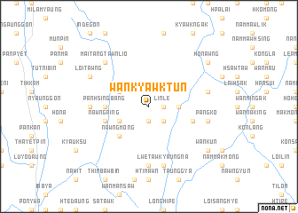
Wān Kyawk Tun (Shan, Myanmar)Wān Kyawk Tun is a town in the Shan region of Myanmar. An overview map of the region around Wān Kyawk Tun is displayed below.
regional and 3d topo map of Wān Kyawk Tun, Myanmar ::
Wān Kyawk Tun airports ::
The nearest airport is HEH - Heho, located 42.7 km south west of Wān Kyawk Tun.
Other airports nearby include MDL - Mandalay Intl (135.0 km north west), LSH - Lashio (226.7 km north), Nearby towns ::
Mak King (1.9km south) //
Wān Loi Pan (1.7km east) //
Linle (1.7km east) //
Wān Nā Hit (2.5km south east) //
Wān Nan Wān (3.5km east) //
Mai Tang Hsong (3.9km south west) //
Taklit (3.9km north west) //
Nawngmong (5.1km south west) //
Pan Hsingbang (5.2km west) //
Mak Mong Hsong (5.5km east) //
Nawng Ping (5.5km west) //
Hsa-lai (7.4km south) //
Nyaungzin (6.9km west) //
Lwetaw Kyaungna (7.6km south) //
Pangko (7.2km east) //
Wan Nawng King (7.2km east) //
Mai Tang Tawn Lio (7.6km north west) //
Loi Tawng (7.8km north west) //
Peinnebin (8.9km south east) //
Wānkun (8.9km south east) //
Ho-nawng (8.9km north east) //
[all distances 'as the bird flies' and approximate] 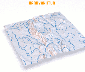 Places with similar names to Wān Kyawk Tun, Myanmar ::
// Wān Kyauktan (MM)
Disclaimer :: Information on this page comes without warranty of any kind |
||
|
Where is Wān Kyawk Tun? Elevation and coordinates ::
Latitude (lat): 21°2'0"N Longitude (lon): 97°4'0"E
Elevation (approx.): 1077m (map arrows pan, magnifying glasses zoom) |
||
|
Visiting Wān Kyawk Tun? Hotel/Accommodation ::
Book a hotel in Wān Kyawk Tun Travel Guide ::
Buy a travel guide for Myanmar rental cars ::
car rental offers GPS waypoint ::
download a GPX waypoint (PoI) of Wān Kyawk Tun for your GPS receiver
|
||