|
search place name
|
||
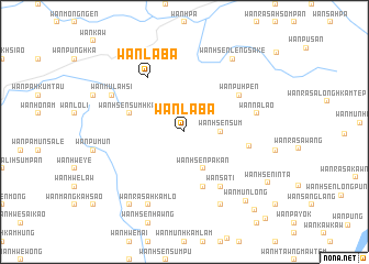
Wān La-bā (Shan, Myanmar)Wān La-bā is a town in the Shan region of Myanmar. An overview map of the region around Wān La-bā is displayed below.
regional and 3d topo map of Wān La-bā, Myanmar ::
Wān La-bā airports ::
The nearest airport is THL - Tachilek Tachileik, located 55.3 km south west of Wān La-bā.
Other airports nearby include KET - Kengtung (72.5 km north west), MOG - Mong Hsat (107.8 km south west), LPQ - Luang Prabang Luang Phabang Intl (233.7 km south east), Nearby towns ::
Wān Hsensüm (3.5km east) //
Wān Hsenpa-kan (4.1km south east) //
Wān Hsensumhkam (5.5km west) //
Wān Münlōng (5.8km south) //
Wān Pu-hpen (6.4km north east) //
Wān Sa-ti (6.6km south east) //
Wān La-bā (6.5km north west) //
Wān Hsenghpūng (6.3km east) //
Wān Na-lao (7.2km east) //
Wān Pangkawlao (8.2km north west) //
Wān Hsenkēm (8.2km south east) //
Wān Mu-la-hsi (7.9km north west) //
Wān Ra-sa-hkamlö (8.2km south west) //
Wān Hsenlēngsa-kē (8.7km north east) //
Wān Hsenhkam-hsao (9.1km south west) //
Wān Mūnlöng (9.1km south east) //
Wān Hseninta (9.5km south east) //
Wān Hsenlü-sau (10.4km south east) //
Wān Ai-la-long (11.7km south east) //
[all distances 'as the bird flies' and approximate]  Places with similar names to Wān La-bā, Myanmar ::
Disclaimer :: Information on this page comes without warranty of any kind |
||
|
Where is Wān La-bā? Elevation and coordinates ::
Latitude (lat): 20°55'0"N Longitude (lon): 100°12'0"E
Elevation (approx.): 1042m (map arrows pan, magnifying glasses zoom) |
||
|
Visiting Wān La-bā? Hotel/Accommodation ::
Book a hotel in Wān La-bā Travel Guide ::
Buy a travel guide for Myanmar rental cars ::
car rental offers GPS waypoint ::
download a GPX waypoint (PoI) of Wān La-bā for your GPS receiver
|
||