|
search place name
|
||
Wān Long Hsa La (Shan, Myanmar)Wān Long Hsa La is a town in the Shan region of Myanmar. An overview map of the region around Wān Long Hsa La is displayed below.
regional and 3d topo map of Wān Long Hsa La, Myanmar ::

Wān Long Hsa La airports ::
The nearest airport is HEH - Heho, located 74.1 km south west of Wān Long Hsa La.
Other airports nearby include MDL - Mandalay Intl (147.2 km west), LSH - Lashio (200.5 km north), MOG - Mong Hsat (217.9 km east), Nearby towns ::
Wān Ngai (2.5km north east) //
Hpak Hkyem (3.5km east) //
Wān Ta Mai (5.1km south east) //
Hkok Lin (5.6km south) //
Nam Pa Lan (5.6km south) //
Hwè Kot (5.5km east) //
Leng Aka (6.4km north east) //
Wān Tan (6.5km north east) //
Mak Mo (6.4km south east) //
Kong Möng (6.4km south east) //
Wān Kong (7.4km south) //
Pang Yam (7.2km east) //
Nawng Hsong (7.2km east) //
Wān Mau (7.6km south) //
Na-tit (7.6km south east) //
Kong Nyawng (8.2km south east) //
Nā-wing (7.8km south east) //
Nyawng Tawk (8.9km north west) //
Nōn Nā (9.0km south east) //
Ho-nā (10.1km south east) //
[all distances 'as the bird flies' and approximate] 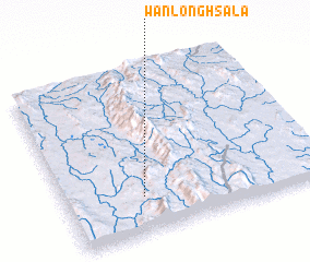 Places with similar names to Wān Long Hsa La, Myanmar :: Disclaimer :: Information on this page comes without warranty of any kind |
||
|
Where is Wān Long Hsa La? Elevation and coordinates ::
Latitude (lat): 21°13'0"N Longitude (lon): 97°18'0"E
Elevation (approx.): 1213m (map arrows pan, magnifying glasses zoom) |
||
|
Visiting Wān Long Hsa La? Hotel/Accommodation ::
Book a hotel in Wān Long Hsa La Travel Guide ::
Buy a travel guide for Myanmar rental cars ::
car rental offers GPS waypoint ::
download a GPX waypoint (PoI) of Wān Long Hsa La for your GPS receiver
|
||