|
search place name
|
||
Wān Mün-a-hsa (Shan, Myanmar)Wān Mün-a-hsa is a town in the Shan region of Myanmar. An overview map of the region around Wān Mün-a-hsa is displayed below.
regional and 3d topo map of Wān Mün-a-hsa, Myanmar ::

Wān Mün-a-hsa airports ::
The nearest airport is THL - Tachilek Tachileik, located 19.9 km north east of Wān Mün-a-hsa.
Other airports nearby include MOG - Mong Hsat (60.8 km west), KET - Kengtung (107.1 km north), Nearby towns ::
Wān Münyaw (0.8km north west) //
Wān Lā-bā (2.3km south west) //
Wān Hsenpawmöng (2.6km west) //
Ban Musoe La Ba (3.1km south) //
Ban Ko Doi Tung (3.4km south east) //
Wān Hsenlōng (3.4km north east) //
Ban Musoe Khoi Tung (3.8km south) //
Ban Ko (4.3km south west) //
Ban Cha Lo (4.6km south west) //
Ban Pa Bu (4.9km south) //
Ban Musoe Doi Tung (5.0km south) //
Wān Tū-kiao (5.1km north) //
Ban Pa Kluai La Hu (5.3km south) //
Wān Lā-bā (5.3km west) //
Ban I-Ko Pa Kluai (6.2km south) //
Wān Hsenkek (6.1km north) //
Wān Kē-noi (6.1km north east) //
Ban I-Ko Pa Kluai (6.2km south) //
Ban Kluai (6.5km south) //
Ban Pa Yang Kiao (6.4km south west) //
Ban Tham Pla (6.4km east) //
Ban Phak Chaonathi Phra Tamnak Doi Tung (6.8km south) //
Ban Phuttha Sathan Tham Pla (6.6km east) //
Ban Pa Yang Musoe (6.8km south west) //
Ban Pa Yang (6.9km south west) //
Ban Dong (6.7km east) //
Ban Pha Mi (7.0km north east) //
Ban Pa Yana Saen Sut Daen (6.8km south west) //
Wān Hanmi (7.3km north) //
[all distances 'as the bird flies' and approximate] 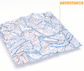 Places with similar names to Wān Mün-a-hsa, Myanmar ::
// Wān Münsai (MM)
// Wān Mansaw (MM)
// Wān Mün-a-hsa (MM)
// Wān Münhsai (MM)
// Wān Münsai (MM)
// Wān Münsai (MM)
// Wān Münsai (MM)
// Wān Münsai (MM)
Disclaimer :: Information on this page comes without warranty of any kind |
||
|
Where is Wān Mün-a-hsa? Elevation and coordinates ::
Latitude (lat): 20°20'53"N Longitude (lon): 99°48'39"E
Elevation (approx.): 1293m (map arrows pan, magnifying glasses zoom) |
||
|
Visiting Wān Mün-a-hsa? Hotel/Accommodation ::
Book a hotel in Wān Mün-a-hsa Travel Guide ::
Buy a travel guide for Myanmar rental cars ::
car rental offers GPS waypoint ::
download a GPX waypoint (PoI) of Wān Mün-a-hsa for your GPS receiver
|
||