|
search place name
|
||
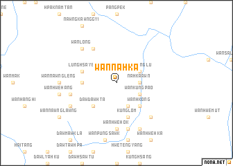
Wān Na-hka (Shan, Myanmar)Wān Na-hka is a town in the Shan region of Myanmar. An overview map of the region around Wān Na-hka is displayed below.
regional and 3d topo map of Wān Na-hka, Myanmar ::
Wān Na-hka airports ::
The nearest airport is HEH - Heho, located 118.2 km north west of Wān Na-hka.
Other airports nearby include MOG - Mong Hsat (184.5 km east), MDL - Mandalay Intl (253.2 km north west), LPT - Lampang (277.1 km south east), Nearby towns ::
Na-hka-awn (3.5km east) //
Kantu-long (4.1km south east) //
Wān Kūngpao (3.9km south east) //
Wān Pānglu (3.9km north east) //
Daw Dawhta (5.1km south west) //
Wān Hkōng (5.1km south east) //
Wān Pāngman (5.2km west) //
Kūnglom (5.8km south) //
Lünghsa-ye (5.5km west) //
Pāngngawk (6.6km north west) //
Wān Lūktan (7.4km south) //
Wān Hwè-hok (7.4km south) //
Wān Na-hi (7.2km west) //
Pangkeng (7.6km south) //
Wān Nawngkao (7.6km south east) //
Wān Long (7.6km north west) //
Daw Pi-tu (7.9km south west) //
Wān Mè-sa-lawm (8.2km south east) //
[all distances 'as the bird flies' and approximate] 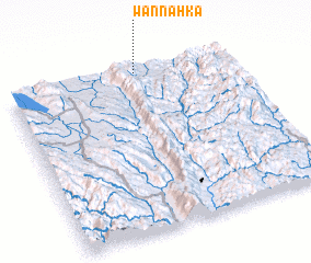 Places with similar names to Wān Na-hka, Myanmar ::
Disclaimer :: Information on this page comes without warranty of any kind |
||
|
Where is Wān Na-hka? Elevation and coordinates ::
Latitude (lat): 19°59'0"N Longitude (lon): 97°35'0"E
Elevation (approx.): 679m (map arrows pan, magnifying glasses zoom) |
||
|
Visiting Wān Na-hka? Hotel/Accommodation ::
Book a hotel in Wān Na-hka Travel Guide ::
Buy a travel guide for Myanmar rental cars ::
car rental offers GPS waypoint ::
download a GPX waypoint (PoI) of Wān Na-hka for your GPS receiver
|
||