|
search place name
|
||
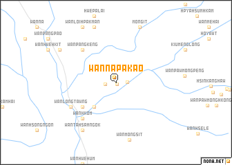
Wān Nā-pā-kao (Shan, Myanmar)Wān Nā-pā-kao is a town in the Shan region of Myanmar. An overview map of the region around Wān Nā-pā-kao is displayed below.
regional and 3d topo map of Wān Nā-pā-kao, Myanmar ::
Wān Nā-pā-kao airports ::
The nearest airport is MOG - Mong Hsat, located 42.5 km north east of Wān Nā-pā-kao.
Other airports nearby include THL - Tachilek Tachileik (102.1 km east), KET - Kengtung (137.0 km north east), LPT - Lampang (222.1 km south), Nearby towns ::
Wān Mè-hong (0.3km south east) //
Wān Tinloi (1.6km west) //
Wān Pā-hsak (1.6km west) //
Wān Yang (1.7km east) //
Wān Ho-sai (5.2km south west) //
Wān Mèsai (5.2km south west) //
Wān Namhū-omhkom (5.2km south west) //
Wān Mè-kin (6.5km south west) //
Wān Hsupsai (6.5km south west) //
Wān Pāngkeng (7.3km north west) //
Wān Hkom (7.8km south west) //
Wān Longtawng (7.9km south west) //
Wān Tā-hsamngok (9.2km south west) //
[all distances 'as the bird flies' and approximate]  Places with similar names to Wān Nā-pā-kao, Myanmar ::
// Winnipauk (US)
// Winnipeg (US)
// Winnipeg (CA)
// Wān Pu-kè (MM)
// Wān Hpā-hkao (MM)
// Wān Pa-kao (MM)
// Wān Pa-hkā (MM)
// Wān Pa-hka (MM)
// Wān Pa-hka (MM)
// Wounapaka (VU)
Disclaimer :: Information on this page comes without warranty of any kind |
||
|
Where is Wān Nā-pā-kao? Elevation and coordinates ::
Latitude (lat): 20°13'10"N Longitude (lon): 98°59'55"E
Elevation (approx.): 512m (map arrows pan, magnifying glasses zoom) |
||
|
Visiting Wān Nā-pā-kao? Hotel/Accommodation ::
Book a hotel in Wān Nā-pā-kao Travel Guide ::
Buy a travel guide for Myanmar rental cars ::
car rental offers GPS waypoint ::
download a GPX waypoint (PoI) of Wān Nā-pā-kao for your GPS receiver
|
||