|
search place name
|
||
Wān Pawkang (Shan, Myanmar)Wān Pawkang is a town in the Shan region of Myanmar. An overview map of the region around Wān Pawkang is displayed below.
regional and 3d topo map of Wān Pawkang, Myanmar ::

Wān Pawkang airports ::
The nearest airport is KET - Kengtung, located 44.1 km north west of Wān Pawkang.
Other airports nearby include THL - Tachilek Tachileik (59.0 km south), MOG - Mong Hsat (89.6 km south west), Nearby towns ::
Wān Hkang Ho-paw (2.5km north east) //
Wān Ho-paw (2.5km north east) //
Wān Namhkè (3.5km west) //
Wān Mün Hsi-kawn (3.5km west) //
Wān Hsen-hkün (5.1km north west) //
Wān Hsa-hpü (5.1km north west) //
Wān Hsenhpöm (5.1km north west) //
Wān Pu-mün (5.1km south west) //
Wān La-pa (5.2km west) //
Wān Sa-na (5.8km south) //
Wān Münhkün (5.8km north) //
Wān Sa-hsa-law (5.8km north) //
Wān Hsen-üm (6.5km south west) //
Wān Hsenhpöm (6.4km north west) //
Wān Loi-ta (7.4km north) //
Wān Hsenmau (7.4km north) //
Wān Hsenpu-hkam (7.6km north) //
Wān Hsensawmawng (7.2km west) //
Wān Pu-moi (7.9km south west) //
Wān Makhkampawm (9.1km south east) //
Wān Namlao (10.1km south west) //
[all distances 'as the bird flies' and approximate] 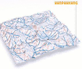 Places with similar names to Wān Pawkang, Myanmar ::
Disclaimer :: Information on this page comes without warranty of any kind |
||
|
Where is Wān Pawkang? Elevation and coordinates ::
Latitude (lat): 21°1'0"N Longitude (lon): 99°56'0"E
Elevation (approx.): 1131m (map arrows pan, magnifying glasses zoom) |
||
|
Visiting Wān Pawkang? Hotel/Accommodation ::
Book a hotel in Wān Pawkang Travel Guide ::
Buy a travel guide for Myanmar rental cars ::
car rental offers GPS waypoint ::
download a GPX waypoint (PoI) of Wān Pawkang for your GPS receiver
|
||