|
search place name
|
||
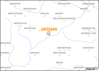
Wān Sa-pē (Shan, Myanmar)Wān Sa-pē is a town in the Shan region of Myanmar. An overview map of the region around Wān Sa-pē is displayed below.
regional and 3d topo map of Wān Sa-pē, Myanmar ::
Wān Sa-pē airports ::
The nearest airport is KET - Kengtung, located 39.1 km north of Wān Sa-pē.
Other airports nearby include MOG - Mong Hsat (59.8 km south west), THL - Tachilek Tachileik (62.3 km south east), Nearby towns ::
Wān Hsenlem (1.9km north) //
Wān Kwi Namkōk (3.9km north west) //
Wān Münsumpūm (6.5km south east) //
Wān Ke-nai (7.6km north) //
Wān Hsenmau (7.2km west) //
Wān Hsenhkiao (7.6km south east) //
Wān Li-hsaw Hkè-hkamhsai (7.6km north east) //
Wān Hsenkammün (7.9km north west) //
Wān Hsat (8.2km north east) //
Wān Panghök (8.2km south east) //
Wān Htamngün (8.2km south east) //
Wān Na-kok (9.1km south west) //
Wān Nga-ho-noi (8.9km south east) //
Möng Wing (10.1km south east) //
Wān Münhkamsao (10.1km south east) //
[all distances 'as the bird flies' and approximate]  Places with similar names to Wān Sa-pē, Myanmar ::
// Winesap (US)
// Winesap (US)
// Winesap (US)
// Wanasepi (ID)
// Wān Hsoppai (MM)
// Wān Sao-hpa (MM)
// Wān Hsa-pu (MM)
// Wān Hsuppa (MM)
// Winesap (US)
// Wān Hsa-hpü (MM)
Disclaimer :: Information on this page comes without warranty of any kind |
||
|
Where is Wān Sa-pē? Elevation and coordinates ::
Latitude (lat): 20°57'0"N Longitude (lon): 99°36'0"E
Elevation (approx.): 1497m (map arrows pan, magnifying glasses zoom) |
||
|
Visiting Wān Sa-pē? Hotel/Accommodation ::
Book a hotel in Wān Sa-pē Travel Guide ::
Buy a travel guide for Myanmar rental cars ::
car rental offers GPS waypoint ::
download a GPX waypoint (PoI) of Wān Sa-pē for your GPS receiver
|
||