|
search place name
|
||
Yelaigyun (Sagaing, Myanmar)Yelaigyun is a town in the Sagaing region of Myanmar. An overview map of the region around Yelaigyun is displayed below.
regional and 3d topo map of Yelaigyun, Myanmar ::

Yelaigyun airports ::
The nearest airport is MDL - Mandalay Intl, located 89.9 km east of Yelaigyun.
Other airports nearby include HEH - Heho (216.2 km south east), Nearby towns ::
Sulekon (1.7km east) //
Nyaungbinhla (1.7km east) //
Yandabin (1.7km east) //
Kongyi (1.7km east) //
Amyin (1.9km south) //
Paungwa (1.7km west) //
Kyetthunse (2.5km south east) //
Bono (2.5km north east) //
Bônmano (2.5km north east) //
Saga (2.5km south west) //
Chaungmana (3.4km east) //
Paungdawu (3.4km west) //
Kantha (3.4km west) //
Shwegu (4.1km south east) //
Kyaung (4.1km south east) //
Waya (4.1km south east) //
Kyaungywa (3.9km north east) //
Kuntha (4.1km south west) //
Kyetthagan (4.1km south west) //
Kanzi (5.1km south east) //
Mayogon (5.1km north east) //
Sadon (5.1km north west) //
Thayetkaing (5.6km south) //
Tèzu (5.8km north) //
Nyaungbyubin (6.5km north east) //
Dudauk (6.5km north west) //
Kinmuntaw (7.1km east) //
Kyaunggon (7.1km west) //
Kandawkyaung (7.6km south) //
[all distances 'as the bird flies' and approximate] 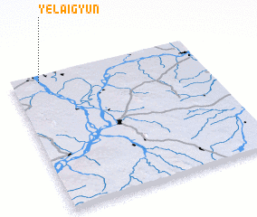 Places with similar names to Yelaigyun, Myanmar ::
// Yelegyun (MM)
Disclaimer :: Information on this page comes without warranty of any kind |
||
|
Where is Yelaigyun? Elevation and coordinates ::
Latitude (lat): 21°57'0"N Longitude (lon): 95°9'0"E
Elevation (approx.): 66m (map arrows pan, magnifying glasses zoom) |
||
|
Visiting Yelaigyun? Hotel/Accommodation ::
Book a hotel in Yelaigyun Travel Guide ::
Buy a travel guide for Myanmar rental cars ::
car rental offers GPS waypoint ::
download a GPX waypoint (PoI) of Yelaigyun for your GPS receiver
|
||