|
search place name
|
||
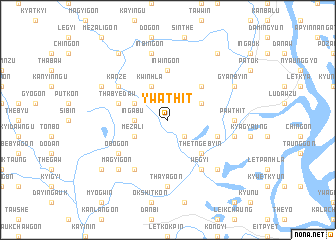
Ywathit (Ayeyarwady, Myanmar)Ywathit is a town in the Ayeyarwady region of Myanmar. An overview map of the region around Ywathit is displayed below.
regional and 3d topo map of Ywathit, Myanmar ::
Ywathit airports ::
The nearest airport is SNW - Thandwe, located 127.6 km north west of Ywathit.
Other airports nearby include RGN - Yangon Intl (134.1 km south east), KYP - Kyaukpyu (257.8 km north west), Nearby towns ::
Zibingwin (2.6km south east) //
Ingabu (3.5km west) //
Pandin (4.0km north west) //
Takethu (4.0km north east) //
Mezali (4.0km south west) //
Kwinhla (4.1km north west) //
Wetlaha (5.1km north east) //
Thetngebyin (5.1km south east) //
Inwingon (5.6km north) //
Thabyedaw (5.6km west) //
Tandawzu (5.6km west) //
Naukmi (5.6km east) //
Gyibaukkon (6.6km south west) //
Kanze (6.5km north west) //
Wegyi (6.6km south east) //
Thanbyadaing (6.6km south east) //
Obogon (6.5km south west) //
Thabyuzeik (7.4km south) //
Pawthit (7.1km east) //
Thayagon (7.4km south) //
Inbingon (7.6km north) //
Yelegyun (7.3km east) //
Pegyigyun (7.7km south east) //
Magyigon (7.7km south west) //
Zaungdan (8.0km north west) //
Gyanbyin (8.0km north east) //
Payagwin (9.1km north west) //
Payāgwin-yele (9.1km north west) //
Yethkanzin (9.1km north east) //
[all distances 'as the bird flies' and approximate] 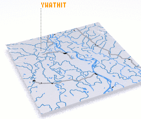 Places with similar names to Ywathit, Myanmar ::
Disclaimer :: Information on this page comes without warranty of any kind |
||
|
Where is Ywathit? Elevation and coordinates ::
Latitude (lat): 17°49'0"N Longitude (lon): 95°18'0"E
Elevation (approx.): 15m (map arrows pan, magnifying glasses zoom) |
||
|
Visiting Ywathit? Hotel/Accommodation ::
Book a hotel in Ywathit Travel Guide ::
Buy a travel guide for Myanmar rental cars ::
car rental offers GPS waypoint ::
download a GPX waypoint (PoI) of Ywathit for your GPS receiver
|
||