|
search place name
|
||
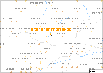
Aguemount-n-Aït Amar (Algeria)Aguemount-n-Aït Amar is a town in Algeria. An overview map of the region around Aguemount-n-Aït Amar is displayed below.
regional and 3d topo map of Aguemount-n-Aït Amar, Algeria ::
Aguemount-n-Aït Amar airports ::
The nearest airport is BJA - Bejaja Soummam, located 31.6 km east of Aguemount-n-Aït Amar.
Other airports nearby include GJL - Jijel (103.7 km east), ALG - Algier Houari Boumediene (134.2 km west), CZL - Constantine Mohamed Boudiaf Intl (177.4 km east), BSK - Biskra (232.5 km south east), Nearby towns ::
Aït Idir (1.9km north) //
Tizi el Korn (1.5km west) //
Taourirt Ighil (2.4km south west) //
Iksilene (3.0km east) //
Aït Maamar (3.7km north) //
Aït Saïd (4.8km north east) //
Ouenouga (4.8km north west) //
Adekar Kebouche (4.6km south west) //
Cheurfa (4.5km east) //
Irhzer Abbas (5.8km north) //
Tizi Tifra (5.8km south) //
Tifra (5.9km south) //
Fetala (6.3km south west) //
Kebouch (5.9km west) //
Tizi Ourhni (5.9km west) //
Il Matene (7.1km south east) //
Irtabene (7.1km north west) //
Tirhilt Makhlouf (7.0km south east) //
Takamra (7.0km south west) //
Oued Bel Kassem (8.1km south east) //
Takhlijt (8.1km south east) //
Ichekfiouine (8.1km north east) //
El Kelaa Ouadda (8.7km south west) //
Haniet (8.7km south west) //
Mzid (8.7km south west) //
Timezrit Il Matten (9.0km south east) //
Taourirt-n-Aït Ou Aïssa (9.5km south west) //
[all distances 'as the bird flies' and approximate] 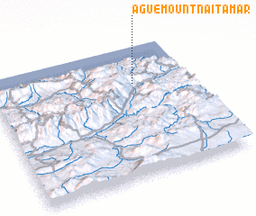 Places with similar names to Aguemount-n-Aït Amar, Algeria :: Disclaimer :: Information on this page comes without warranty of any kind |
||
|
Where is Aguemount-n-Aït Amar? Elevation and coordinates ::
Latitude (lat): 36°43'0"N Longitude (lon): 4°43'0"E
Elevation (approx.): 571m (map arrows pan, magnifying glasses zoom) |
||
|
Visiting Aguemount-n-Aït Amar? Hotel/Accommodation ::
Book a hotel in Aguemount-n-Aït Amar Travel Guide ::
Buy a travel guide for Algeria rental cars ::
car rental offers GPS waypoint ::
download a GPX waypoint (PoI) of Aguemount-n-Aït Amar for your GPS receiver
|
||