|
search place name
|
||
Aït Illoul (Algeria)Aït Illoul is a town in Algeria. An overview map of the region around Aït Illoul is displayed below.
regional and 3d topo map of Aït Illoul, Algeria ::

Aït Illoul airports ::
The nearest airport is BJA - Bejaja Soummam, located 65.1 km east of Aït Illoul.
Other airports nearby include ALG - Algier Houari Boumediene (104.6 km west), GJL - Jijel (134.7 km east), Nearby towns ::
Issoumatene (1.5km west) //
Achouba (2.4km south east) //
Abbech (3.0km east) //
Tiouidiouine (3.5km south west) //
Irhil Mahani (5.2km south west) //
Taguemount (4.8km south east) //
Aït Temouchene (5.8km south) //
Azeffoun (5.6km north east) //
Agachene (5.8km south west) //
Ianouchene (5.9km west) //
Agraredj (7.4km south) //
Taoudouch (6.2km west) //
Tamassit (7.6km south) //
Oubellil (6.5km west) //
Aït Raouna (7.0km north west) //
Kelaa (6.9km south east) //
Arhribs (8.2km south west) //
El Ma Guechtoum (8.1km south east) //
Adrar (8.1km south west) //
Tifrit-n-Aït el Hadj (8.9km south east) //
[all distances 'as the bird flies' and approximate] 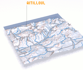 Places with similar names to Aït Illoul, Algeria ::
// Aouid Ellèl (TD)
// At Tulūl (SY)
// At Tulayl (LB)
// Aït Ali Ou Allah (MA)
// Aït Lil (MA)
// Aït Lahlou (MA)
// Aït Oualil (MA)
// Aït Illoul (MA)
// Adi Alele (ET)
// Aït Ahlal (DZ)
Disclaimer :: Information on this page comes without warranty of any kind |
||
|
Where is Aït Illoul? Elevation and coordinates ::
Latitude (lat): 36°52'0"N Longitude (lon): 4°22'0"E
Elevation (approx.): 463m (map arrows pan, magnifying glasses zoom) |
||
|
Visiting Aït Illoul? Hotel/Accommodation ::
Book a hotel in Aït Illoul Travel Guide ::
Buy a travel guide for Algeria rental cars ::
car rental offers GPS waypoint ::
download a GPX waypoint (PoI) of Aït Illoul for your GPS receiver
|
||