|
search place name
|
||
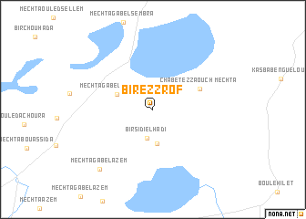
Bir ez Zrof (Oum el Bouaghi, Algeria)Bir ez Zrof is a town in the Oum el Bouaghi region of Algeria. An overview map of the region around Bir ez Zrof is displayed below.
regional and 3d topo map of Bir ez Zrof, Algeria ::
Bir ez Zrof airports ::
The nearest airport is CZL - Constantine Mohamed Boudiaf Intl, located 51.7 km north of Bir ez Zrof.
Other airports nearby include GJL - Jijel (123.4 km north west), BSK - Biskra (134.2 km south west), TEE - Tebessa Cheikh Larbi Tebessi (150.7 km east), AAE - Annaba (160.5 km north east), Nearby towns ::
Bir Sidi el Hadi (3.6km south) //
Djebel el Gountas (4.2km south) //
Mechta Gabel Tarbennt (4.0km north west) //
Mechta Chabet ez Zaouch (5.3km north east) //
Mechta Gabel Azem (9.1km south west) //
[all distances 'as the bird flies' and approximate] 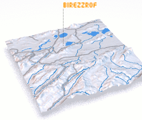 Places with similar names to Bir ez Zrof, Algeria ::
// Biéré Saraf (TD)
// Barrys Reef (AU)
Disclaimer :: Information on this page comes without warranty of any kind |
||
|
Where is Bir ez Zrof? Elevation and coordinates ::
Latitude (lat): 35°48'58"N Longitude (lon): 6°31'32"E
Elevation (approx.): 804m (map arrows pan, magnifying glasses zoom) |
||
|
Visiting Bir ez Zrof? Hotel/Accommodation ::
Book a hotel in Bir ez Zrof Travel Guide ::
Buy a travel guide for Algeria rental cars ::
car rental offers GPS waypoint ::
download a GPX waypoint (PoI) of Bir ez Zrof for your GPS receiver
|
||