|
search place name
|
||
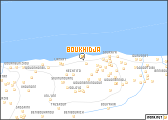
Boukhidja (Tipaza, Algeria)Boukhidja is a town in the Tipaza region of Algeria. An overview map of the region around Boukhidja is displayed below.
regional and 3d topo map of Boukhidja, Algeria ::
Boukhidja airports ::
The nearest airport is QAS - Ech-cheliff Ech Cheliff, located 60.7 km south west of Boukhidja.
Other airports nearby include ALG - Algier Houari Boumediene (122.9 km east), TID - Tiaret Bou Chekif (140.1 km south), MUW - Ghriss (215.1 km south west), Nearby towns ::
Douar Soukhlidja (0.9km south east) //
Azouna (2.7km south east) //
Douar Sadouna (3.3km south east) //
Bou Aziza (3.6km south east) //
Mechta Tardet (3.3km south east) //
Douar Ibelaïdene (3.5km south east) //
Mechtita (3.8km south west) //
Domaine Ghazli (3.5km east) //
Douar Noraïa (4.4km south) //
Douar Mouafak (4.1km south east) //
Domaine Sidi Bennedjar (3.9km west) //
Douar Sidi Barkouk (4.0km east) //
Larhat (4.5km south west) //
Douar Bouankouda (4.2km east) //
Larhat (4.3km west) //
Ouled Mokhtar (5.2km south east) //
Douar Sidi Barkouk (4.6km east) //
Zrouka (4.6km east) //
Gouraya (4.7km east) //
Douar Ibouamamaïne (4.8km east) //
Douar Beni Nadour (6.0km south) //
Douar Iynayene (5.2km east) //
El Kalla (5.7km south east) //
Douar Sidi Yahia (5.6km south east) //
Douar Beni Ouarkchene (6.2km south west) //
Douar Arbal (6.8km south) //
Sidi Merouane (6.3km south west) //
Douar Beni Aïrour (6.9km south) //
Taoutat (7.0km south) //
[all distances 'as the bird flies' and approximate] 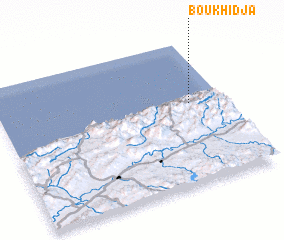 Places with similar names to Boukhidja, Algeria :: Disclaimer :: Information on this page comes without warranty of any kind |
||
|
Where is Boukhidja? Elevation and coordinates ::
Latitude (lat): 36°33'48"N Longitude (lon): 1°51'3"E
Elevation (approx.): 121m (map arrows pan, magnifying glasses zoom) |
||
|
Visiting Boukhidja? Hotel/Accommodation ::
Book a hotel in Boukhidja Travel Guide ::
Buy a travel guide for Algeria rental cars ::
car rental offers GPS waypoint ::
download a GPX waypoint (PoI) of Boukhidja for your GPS receiver
|
||