|
search place name
|
||
Boumerdas (Boumerdes, Algeria)Boumerdas is a town in the Boumerdes region of Algeria. An overview map of the region around Boumerdas is displayed below.
regional and 3d topo map of Boumerdas, Algeria ::

Boumerdas airports ::
The nearest airport is ALG - Algier Houari Boumediene, located 24.8 km west of Boumerdas.
Other airports nearby include BJA - Bejaja Soummam (142.4 km east), Nearby towns ::
Ouled Abdelkrim (2.6km east) //
Oulad Ben Kassem (3.8km south) //
Corso Tahtani (3.3km south west) //
El Karma (3.5km east) //
Tidjelabine (4.5km south east) //
Sainte-Marie du Corso (5.6km south) //
Beni Fouda (5.9km south) //
Ouled Mnassir (5.2km east) //
Ouled Ben Bekhta (7.8km south) //
Benhammouch (6.5km east) //
Sidi Hallou (7.8km south west) //
Boudouaou (7.2km south west) //
Mraiels (8.2km south east) //
Bou Daoua el Bahri (7.1km west) //
Ben Turkia (7.8km south west) //
Thenia (8.1km south east) //
Guedera (9.8km south east) //
[all distances 'as the bird flies' and approximate] 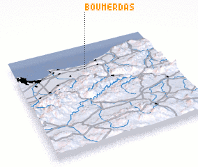 Places with similar names to Boumerdas, Algeria ::
// Bū Mirdās (TN)
Disclaimer :: Information on this page comes without warranty of any kind |
||
|
Where is Boumerdas? Elevation and coordinates ::
Latitude (lat): 36°46'0"N Longitude (lon): 3°28'38"E
Elevation (approx.): 5m (map arrows pan, magnifying glasses zoom) |
||
|
Visiting Boumerdas? Hotel/Accommodation ::
Book a hotel in Boumerdas Travel Guide ::
Buy a travel guide for Algeria rental cars ::
car rental offers GPS waypoint ::
download a GPX waypoint (PoI) of Boumerdas for your GPS receiver
|
||