|
search place name
|
||
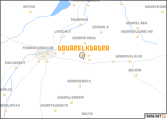
Douar el Kdadra (Sidi Bel Abbès, Algeria)Douar el Kdadra is a town in the Sidi Bel Abbès region of Algeria. An overview map of the region around Douar el Kdadra is displayed below.
regional and 3d topo map of Douar el Kdadra, Algeria ::
Douar el Kdadra airports ::
The nearest airport is TAF - Oran Tafaraoui, located 39.5 km north of Douar el Kdadra.
Other airports nearby include ORN - Oran Es Senia (48.8 km north), MUW - Ghriss (64.4 km east), TLM - Tlemcen Zenata (83.4 km west), OUD - Oujda Angads (132.3 km west), Nearby towns ::
Douar el Gouassem (1.0km east) //
Douar el Khleïfia (1.3km north east) //
Douar Mehadid (3.7km north) //
Faubourg Bou Melik Abdelkader (4.0km west) //
Douar Obbaʼîch (6.0km south) //
Faubourg Cheïkh Ben Bâdis (5.4km west) //
Douar Oulad Safi (5.4km east) //
Le Rocher (6.4km north west) //
Zerouala (7.0km north east) //
Sidi Brahim (7.9km north) //
Ayet Mustapha Ben Boû Laʼïd (6.8km west) //
Ayet el ʼArbi Ben Lemhidi (6.9km west) //
[all distances 'as the bird flies' and approximate] 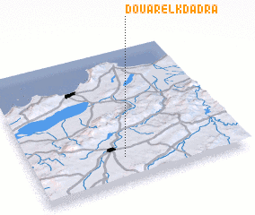 Places with similar names to Douar el Kdadra, Algeria ::
Disclaimer :: Information on this page comes without warranty of any kind |
||
|
Where is Douar el Kdadra? Elevation and coordinates ::
Latitude (lat): 35°11'12"N Longitude (lon): 0°33'33"W
Elevation (approx.): 531m (map arrows pan, magnifying glasses zoom) |
||
|
Visiting Douar el Kdadra? Hotel/Accommodation ::
Book a hotel in Douar el Kdadra Travel Guide ::
Buy a travel guide for Algeria rental cars ::
car rental offers GPS waypoint ::
download a GPX waypoint (PoI) of Douar el Kdadra for your GPS receiver
|
||