|
search place name
|
||
Douar Mosbaha (Tizi Ouzou, Algeria)Douar Mosbaha is a town in the Tizi Ouzou region of Algeria. An overview map of the region around Douar Mosbaha is displayed below.
regional and 3d topo map of Douar Mosbaha, Algeria ::

Douar Mosbaha airports ::
The nearest airport is ALG - Algier Houari Boumediene, located 34.4 km north west of Douar Mosbaha.
Other airports nearby include BJA - Bejaja Soummam (137.1 km east), Nearby towns ::
Ouled Tessala (3.0km east) //
Oulad Bou Guern (4.5km south) //
Lakhdaria (4.5km north east) //
Douar Tazerout (4.8km west) //
Oulad Bel Kassem (6.4km south) //
Ouled Guergour (6.7km north) //
Ouled Oula (7.2km north east) //
Emboula (6.4km south east) //
Oulad Saïdi (8.1km south west) //
Djenane Rad (7.7km south east) //
Village de Baba Ali (8.8km north east) //
Oulad Ziane (8.6km north west) //
Zouggara (9.0km north west) //
Tala Madi (10.2km north east) //
[all distances 'as the bird flies' and approximate] 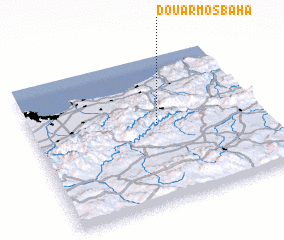 Places with similar names to Douar Mosbaha, Algeria ::
// Douar Msabha (MA)
Disclaimer :: Information on this page comes without warranty of any kind |
||
|
Where is Douar Mosbaha? Elevation and coordinates ::
Latitude (lat): 36°32'26"N Longitude (lon): 3°33'7"E
Elevation (approx.): 495m (map arrows pan, magnifying glasses zoom) |
||
|
Visiting Douar Mosbaha? Hotel/Accommodation ::
Book a hotel in Douar Mosbaha Travel Guide ::
Buy a travel guide for Algeria rental cars ::
car rental offers GPS waypoint ::
download a GPX waypoint (PoI) of Douar Mosbaha for your GPS receiver
|
||