|
search place name
|
||
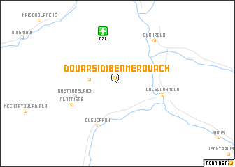
Douar Sidi Ben Merouach (Constantine, Algeria)Douar Sidi Ben Merouach is a town in the Constantine region of Algeria. An overview map of the region around Douar Sidi Ben Merouach is displayed below.
regional and 3d topo map of Douar Sidi Ben Merouach, Algeria ::
Douar Sidi Ben Merouach airports ::
The nearest airport is CZL - Constantine Mohamed Boudiaf Intl, located 8.4 km north of Douar Sidi Ben Merouach.
Other airports nearby include GJL - Jijel (95.1 km north west), AAE - Annaba (125.3 km north east), BJA - Bejaja Soummam (151.7 km west), TEE - Tebessa Cheikh Larbi Tebessi (158.8 km south east), Nearby towns ::
Douar Kassandji (3.7km west) //
Guettar el Aïch (5.8km west) //
El Guerrah (7.2km south) //
Ouled Rahmoun (6.2km east) //
Platrière (6.8km south west) //
El Khroub (8.3km north east) //
[all distances 'as the bird flies' and approximate]  Places with similar names to Douar Sidi Ben Merouach, Algeria :: Disclaimer :: Information on this page comes without warranty of any kind |
||
|
Where is Douar Sidi Ben Merouach? Elevation and coordinates ::
Latitude (lat): 36°12'7"N Longitude (lon): 6°38'25"E
Elevation (approx.): 723m (map arrows pan, magnifying glasses zoom) |
||
|
Visiting Douar Sidi Ben Merouach? Hotel/Accommodation ::
Book a hotel in Douar Sidi Ben Merouach Travel Guide ::
Buy a travel guide for Algeria rental cars ::
car rental offers GPS waypoint ::
download a GPX waypoint (PoI) of Douar Sidi Ben Merouach for your GPS receiver
|
||