|
search place name
|
||
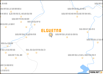
El Guetna (Algeria)El Guetna is a town in Algeria. An overview map of the region around El Guetna is displayed below.
regional and 3d topo map of El Guetna, Algeria ::
El Guetna airports ::
The nearest airport is MUW - Ghriss, located 35.8 km south east of El Guetna.
Other airports nearby include TAF - Oran Tafaraoui (36.3 km north west), ORN - Oran Es Senia (47.9 km north west), TLM - Tlemcen Zenata (122.3 km west), TID - Tiaret Bou Chekif (149.7 km east), Nearby towns ::
Douar Ouled Attou (2.4km north west) //
Douar Oulad Sidi Saïd (4.5km east) //
ʼAïn Cheurfa (6.8km north west) //
Ouled Guenndouzi (7.2km south west) //
Dar Dechera Inadene (9.3km south west) //
[all distances 'as the bird flies' and approximate] 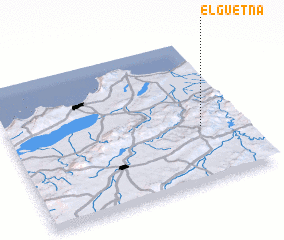 Places with similar names to El Guetna, Algeria ::
Disclaimer :: Information on this page comes without warranty of any kind |
||
|
Where is El Guetna? Elevation and coordinates ::
Latitude (lat): 35°23'0"N Longitude (lon): 0°11'0"W
Elevation (approx.): 467m (map arrows pan, magnifying glasses zoom) |
||
|
Visiting El Guetna? Hotel/Accommodation ::
Book a hotel in El Guetna Travel Guide ::
Buy a travel guide for Algeria rental cars ::
car rental offers GPS waypoint ::
download a GPX waypoint (PoI) of El Guetna for your GPS receiver
|
||