|
search place name
|
||
El Houmour (Mascara, Algeria)El Houmour is a town in the Mascara region of Algeria. An overview map of the region around El Houmour is displayed below.
regional and 3d topo map of El Houmour, Algeria ::

El Houmour airports ::
The nearest airport is MUW - Ghriss, located 5.5 km west of El Houmour.
Other airports nearby include TAF - Oran Tafaraoui (77.2 km north west), ORN - Oran Es Senia (88.7 km north west), TID - Tiaret Bou Chekif (115.3 km east), QAS - Ech-cheliff Ech Cheliff (151.6 km north east), Nearby towns ::
Ouled Ben Aïssa (2.1km north west) //
Khenannsa (2.5km east) //
Rouachi (3.3km north) //
Ouled Abd el Ouahed (3.5km east) //
Douar Ouled el Hâdj el Habîb (4.1km north west) //
Ouled Bou Medienne (4.2km north west) //
Ouled Abdelouahed (4.2km east) //
Caserne de Ghriss (5.0km west) //
Cheïkh Freha (6.3km north east) //
Oulad Bou Kaddour (6.5km north east) //
Sidi Aribi (6.0km east) //
Douar Esafsaf (6.2km east) //
Ghriss (6.9km north west) //
Nessissa (8.0km south) //
El Haïadsa (8.0km north east) //
Douar Ouled Benyahia (8.0km south east) //
Frarda (7.8km south east) //
Oulad Bekhada (9.8km south east) //
[all distances 'as the bird flies' and approximate] 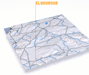 Places with similar names to El Houmour, Algeria ::
Disclaimer :: Information on this page comes without warranty of any kind |
||
|
Where is El Houmour? Elevation and coordinates ::
Latitude (lat): 35°12'1"N Longitude (lon): 0°12'26"W
Elevation (approx.): 558m (map arrows pan, magnifying glasses zoom) |
||
|
Visiting El Houmour? Hotel/Accommodation ::
Book a hotel in El Houmour Travel Guide ::
Buy a travel guide for Algeria rental cars ::
car rental offers GPS waypoint ::
download a GPX waypoint (PoI) of El Houmour for your GPS receiver
|
||