|
search place name
|
||
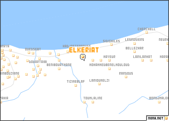
El Keriat (Algeria)El Keriat is a town in Algeria. An overview map of the region around El Keriat is displayed below.
regional and 3d topo map of El Keriat, Algeria ::
El Keriat airports ::
The nearest airport is QAS - Ech-cheliff Ech Cheliff, located 75.8 km south west of El Keriat.
Other airports nearby include ALG - Algier Houari Boumediene (103.9 km east), TID - Tiaret Bou Chekif (144.8 km south), MUW - Ghriss (228.5 km south west), Nearby towns ::
Taberkouk (1.5km east) //
Djaouti (1.9km north) //
Hadjret en Noûss (2.6km north west) //
Annza Absa (3.0km east) //
Fontaine du Génie (3.5km north west) //
Achem (4.5km west) //
Mayeur (4.5km east) //
Messlmoûn (4.7km west) //
Tizi Meblaf (5.8km south) //
Beni Bou Atmane (4.8km south west) //
Mohammed Ben el Mouloud (4.8km south east) //
Lari Ou Melzi (5.9km south east) //
Sidi Ghiles (6.0km north east) //
Messelmoun (6.3km west) //
El Maouzadj (7.7km south west) //
[all distances 'as the bird flies' and approximate] 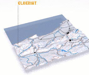 Places with similar names to El Keriat, Algeria ::
// El Kourat (MA)
// El Krada (MA)
// El Kriet (MA)
// El Krit (MA)
// El Carate (PA)
// El Corotú (PA)
// El Corotú (PA)
// El Garrote (PA)
// El Lagarto (PA)
// El Corte (CU)
Disclaimer :: Information on this page comes without warranty of any kind |
||
|
Where is El Keriat? Elevation and coordinates ::
Latitude (lat): 36°33'0"N Longitude (lon): 2°4'0"E
Elevation (approx.): 195m (map arrows pan, magnifying glasses zoom) |
||
|
Visiting El Keriat? Hotel/Accommodation ::
Book a hotel in El Keriat Travel Guide ::
Buy a travel guide for Algeria rental cars ::
car rental offers GPS waypoint ::
download a GPX waypoint (PoI) of El Keriat for your GPS receiver
|
||