|
search place name
|
||
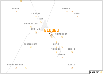
El Oued (El Oued, Algeria)El Oued is a town in the El Oued region of Algeria. An overview map of the region around El Oued is displayed below.
regional and 3d topo map of El Oued, Algeria ::
El Oued airports ::
The nearest airport is TGR - Touggourt Sidi Mahdi, located 79.7 km west of El Oued.
Other airports nearby include TOE - Tozeur Nefta (132.2 km north east), BSK - Biskra (193.4 km north west), HME - Hassi-messaoud Oued Irara (196.9 km south), OGX - Ouargla (209.1 km south west), Nearby towns ::
Oued Touati (0.0km north) //
El Ababsa (1.9km north) //
Sidi el Hachem (2.4km south east) //
Sidi Slimane (3.1km east) //
Amiche (4.0km south east) //
Nezlet Chaâmba (4.8km south east) //
Sidi Liman (5.8km south) //
Ouzitène (5.0km west) //
Tiksebt (6.4km north west) //
Oum Sahouine (7.2km south west) //
Robbah (8.0km south east) //
Sidi Abdallah (7.2km north west) //
Nakhla (8.3km south east) //
Kouinine (8.7km north west) //
El Gourarir Zaouiet (8.7km north west) //
[all distances 'as the bird flies' and approximate] 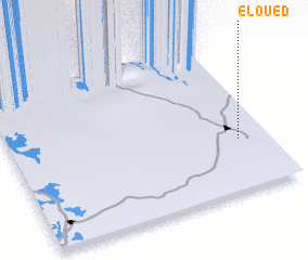 Places with similar names to El Oued, Algeria ::
Disclaimer :: Information on this page comes without warranty of any kind |
||
|
Where is El Oued? Elevation and coordinates ::
Latitude (lat): 33°20'0"N Longitude (lon): 6°53'0"E
Elevation (approx.): 80m (map arrows pan, magnifying glasses zoom) |
||
|
Visiting El Oued? Hotel/Accommodation ::
Book a hotel in El Oued Travel Guide ::
Buy a travel guide for Algeria rental cars ::
car rental offers GPS waypoint ::
download a GPX waypoint (PoI) of El Oued for your GPS receiver
|
||