|
search place name
|
||
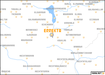
Er Rekta (Sétif, Algeria)Er Rekta is a town in the Sétif region of Algeria. An overview map of the region around Er Rekta is displayed below.
regional and 3d topo map of Er Rekta, Algeria ::
Er Rekta airports ::
The nearest airport is GJL - Jijel, located 42.7 km north east of Er Rekta.
Other airports nearby include BJA - Bejaja Soummam (50.3 km north west), CZL - Constantine Mohamed Boudiaf Intl (97.8 km east), BSK - Biskra (190.0 km south), Nearby towns ::
Dar er Razi (1.5km east) //
Tamazirt (1.5km west) //
Kerm Ali (1.9km north) //
Mechtat el Amarcha (2.9km south) //
Kou Klas (3.3km south east) //
Ech Chebna (4.0km north) //
Meroudj (5.8km north) //
El Allaoucha (5.8km north) //
Ledebla (5.8km north) //
Tabadja (4.8km north east) //
Aoulad Badis (5.5km east) //
Bida (6.9km north) //
En Nemala (6.5km north east) //
Outa Ben Aroun (6.0km east) //
Djouadda (6.0km west) //
Beni Bessez (6.2km west) //
Oulad Bou Renane (7.1km north west) //
Zra el Mial (8.2km north) //
Mechta Tafouda (8.3km south) //
El Gueroua (8.9km north west) //
Bou Amara (8.7km north east) //
Mechtat el Assam (9.5km south east) //
[all distances 'as the bird flies' and approximate] 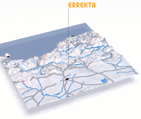 Places with similar names to Er Rekta, Algeria ::
Disclaimer :: Information on this page comes without warranty of any kind |
||
|
Where is Er Rekta? Elevation and coordinates ::
Latitude (lat): 36°30'0"N Longitude (lon): 5°34'0"E
Elevation (approx.): 948m (map arrows pan, magnifying glasses zoom) |
||
|
Visiting Er Rekta? Hotel/Accommodation ::
Book a hotel in Er Rekta Travel Guide ::
Buy a travel guide for Algeria rental cars ::
car rental offers GPS waypoint ::
download a GPX waypoint (PoI) of Er Rekta for your GPS receiver
|
||